
File:KagoshimaMapCurrent.png

本预览的尺寸:800 × 534像素。 其他分辨率:320 × 213像素 | 640 × 427像素 | 1,024 × 683像素 | 1,201 × 801像素。
原始文件 (1,201 × 801像素,文件大小:34 KB,MIME类型:image/png)
摘要
| 描述 |
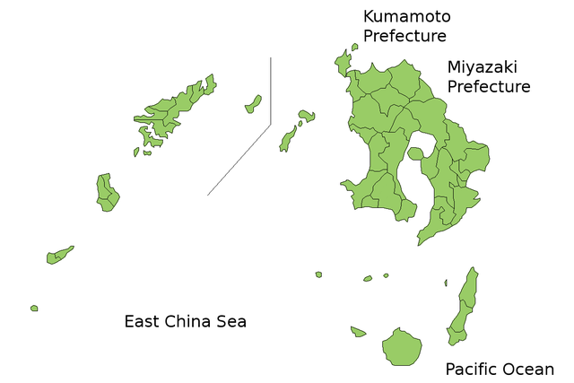
Map of Kagoshima Prefecture, Japan. Thanks to Aoki Shigenobu and [1]. Colors from Image:TokyoMapCurrent.png by User:Fg2. |
| 日期 | 2006年7月21日 (原始上传日期) |
| 来源 | 无法识别来源。根据版权声明推断为其自己的作品。 |
| 作者 | 无法识别作者。根据版权声明推断作者为Akanemoto~commonswiki。 |
许可协议
| 我,本作品著作权人,释出本作品至公有领域。这适用于全世界。 在一些国家这可能不合法;如果是这样的话,那么: 我无条件地授予任何人以任何目的使用本作品的权利,除非这些条件是法律规定所必需的。 |
文件历史
点击某个日期/时间查看对应时刻的文件。
| 日期/时间 | 缩略图 | 大小 | 用户 | 备注 | |
|---|---|---|---|---|---|
| 当前 | 2010年3月23日 (二) 05:17 | | 1,201 × 801(34 KB) | Alberth2 | Kajiki Town, Kamō Town and Aira Tow were merged to Aira City. |
| 2008年11月1日 (六) 02:51 |  | 1,201 × 801(34 KB) | Alberth2 | Ōkuchi and Hishikari merged to Isa. | |
| 2007年12月1日 (六) 05:27 |  | 1,201 × 801(34 KB) | Alberth2 | Kawanabe, Chiran, and Ei are merged into Minamikyūshū ity. | |
| 2007年10月5日 (五) 00:43 |  | 1,201 × 801(34 KB) | Alberth2 | Yaku Town and Kamiyaku Town have merged to Yakushima Town. | |
| 2006年7月29日 (六) 21:12 |  | 1,201 × 801(33 KB) | Akanemoto~commonswiki | fix borders | |
| 2006年7月23日 (日) 23:57 |  | 1,201 × 801(33 KB) | Akanemoto~commonswiki | ||
| 2006年7月22日 (六) 15:46 |  | 1,201 × 801(35 KB) | Akanemoto~commonswiki | ||
| 2006年7月22日 (六) 01:59 |  | 1,201 × 801(34 KB) | Akanemoto~commonswiki | ||
| 2006年7月21日 (五) 21:46 |  | 1,201 × 801(35 KB) | Akanemoto~commonswiki | added Pacific Ocean | |
| 2006年7月21日 (五) 21:32 |  | 1,201 × 801(31 KB) | Akanemoto~commonswiki |
文件用途
没有页面链接到本图像。
全域文件用途
以下其他wiki使用此文件:
- az.wikipedia.org上的用途
- ckb.wikipedia.org上的用途
- cs.wikipedia.org上的用途
- eu.wikipedia.org上的用途
- fa.wikipedia.org上的用途
- fr.wikipedia.org上的用途
- incubator.wikimedia.org上的用途
- jv.wikipedia.org上的用途
- lt.wikipedia.org上的用途
- no.wikipedia.org上的用途
- pl.wikipedia.org上的用途
- pt.wikipedia.org上的用途
- ru.wikipedia.org上的用途
- vi.wikipedia.org上的用途