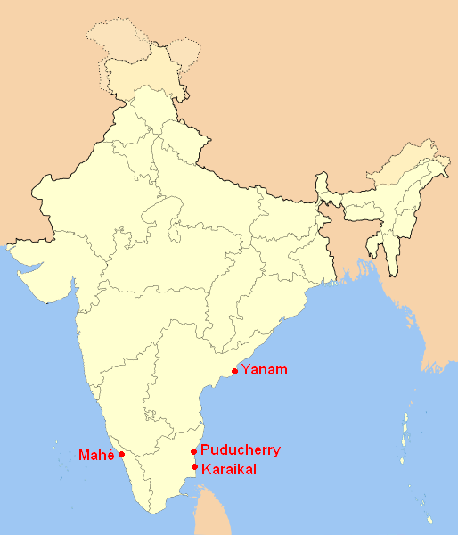
File:Lagekarte Unionsterritorium Puducherry.png
外观
Lagekarte_Unionsterritorium_Puducherry.png (514 × 600像素,文件大小:61 KB,MIME类型:image/png)
文件历史
点击某个日期/时间查看对应时刻的文件。
| 日期/时间 | 缩略图 | 大小 | 用户 | 备注 | |
|---|---|---|---|---|---|
| 当前 | 2008年1月27日 (日) 11:54 |  | 514 × 600(61 KB) | Jungpionier | * locator map of Puducherry (union territory of India); self-made using Image:India-locator-map-blank.svg * Lagekarte von Puducherry (indisches Unionsterritorium); selbst erstellt auf der Grundlage von Image:India-locator-map-blank.svg [[Categ |
文件用途
全域文件用途
以下其他wiki使用此文件:
- ast.wikipedia.org上的用途
- awa.wikipedia.org上的用途
- bn.wikipedia.org上的用途
- br.wikipedia.org上的用途
- en.wikipedia.org上的用途
- en.wikivoyage.org上的用途
- fa.wikipedia.org上的用途
- fr.wikipedia.org上的用途
- hi.wikipedia.org上的用途
- hr.wikipedia.org上的用途
- id.wikipedia.org上的用途
- incubator.wikimedia.org上的用途
- is.wikipedia.org上的用途
- kn.wikipedia.org上的用途
- la.wikipedia.org上的用途
- mai.wikipedia.org上的用途
- ne.wikipedia.org上的用途
- new.wikipedia.org上的用途
- no.wikipedia.org上的用途
- or.wikipedia.org上的用途
- pnb.wikipedia.org上的用途
- ru.wikipedia.org上的用途
- sa.wikipedia.org上的用途
- skr.wikipedia.org上的用途
- ta.wikipedia.org上的用途
- te.wikipedia.org上的用途
- ur.wikipedia.org上的用途
- xmf.wikipedia.org上的用途


