
File:Map of Ireland's capitals.png

本预览的尺寸:470 × 599像素。 其他分辨率:188 × 240像素 | 376 × 480像素 | 602 × 768像素 | 803 × 1,024像素 | 1,630 × 2,078像素。
原始文件 (1,630 × 2,078像素,文件大小:136 KB,MIME类型:image/png)
摘要

|
此map图片可使用矢量图形重新创建为SVG文件。这具有很多好处;更多信息请参见共享资源:待清理媒体。如果存在此图片的SVG格式,请将其上传,然后将此模板替换为
{{vector version available|新图片名称}}。
建议您将SVG命名为“Map of Ireland's capitals.svg”,这样在使用Vector version available(或Vva)模板时就不需要填写新图片名称参数。 |
| 描述 |
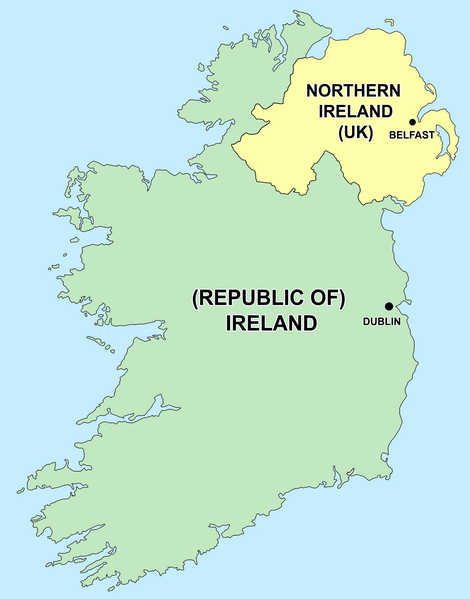
English: Political capitals of the countries Ireland and Northern Ireland Bahasa Indonesia: Ibu kota dari negara Irlandia Utara (Belfast) dan Republik Irlandia (Dublin) |
| 日期 | 2006年12月26日 (原始上传日期) |
| 来源 | 本檔案是由Kajasudhakarababu使用CommonsHelper,從en.wikipedia轉移到維基共享資源。 |
| 作者 | 原上传者为英语维基百科的Jonto |
许可协议
| 本文件采用知识共享署名-相同方式共享 3.0 未本地化版本许可协议授权。 受免責聲明的約束。 | ||
| ||
| 本许可协议标签作为GFDL许可协议更新的组成部分被添加至本文件。 |

|
已授权您依据自由软件基金会发行的无固定段落及封面封底文字(Invariant Sections, Front-Cover Texts, and Back-Cover Texts)的GNU自由文件许可协议1.2版或任意后续版本的条款,复制、传播和/或修改本文件。该协议的副本请见“GNU Free Documentation License”。 受免責聲明的約束。 |
原始上传日志
- delete all current 21:50, 26 December 2006 Thumbnail for version as of 21:50, 26 December 2006 415×541 (13 KB) Jonto (Talk | contribs | block) (Updated as per talk.)
- delete revert 13:42, 11 October 2006 Thumbnail for version as of 13:42, 11 October 2006 415×541 (11 KB) Evertype (Talk | contribs | block) (I re-coloured the existing map and replaced the text on the island.)
- delete revert 04:08, 11 January 2006 Thumbnail for version as of 04:08, 11 January 2006 415×541 (5 KB) Zscout370 (Talk | contribs | block) (Compression)
- delete revert 07:31, 31 May 2005 Thumbnail for version as of 07:31, 31 May 2005 415×541 (14 KB) WikiDon (Talk | contribs | block)
en:Category:Maps of Northern Ireland
文件历史
点击某个日期/时间查看对应时刻的文件。
| 日期/时间 | 缩略图 | 大小 | 用户 | 备注 | |
|---|---|---|---|---|---|
| 当前 | 2015年7月5日 (日) 14:22 | | 1,630 × 2,078(136 KB) | Cmdrjameson | Compressed with pngout. Reduced by 93kB (40% decrease). |
| 2014年9月19日 (五) 00:11 |  | 1,630 × 2,078(229 KB) | Wiki01916 | Improved text legibility and colour as per Map Maker best practises guide. | |
| 2013年12月9日 (一) 01:01 |  | 804 × 1,023(125 KB) | Asarlaí | Reverted to version as of 12 August 2012. This has much clearer writing, shows the border more clearly, shows the size of the capitals more accurately, and has a more neutral color for NI | |
| 2013年9月16日 (一) 10:26 |  | 817 × 1,042(106 KB) | Setanta Saki | Minor fix | |
| 2013年9月16日 (一) 06:58 |  | 817 × 1,042(105 KB) | Setanta Saki | minor fix | |
| 2013年9月16日 (一) 06:44 |  | 817 × 1,042(104 KB) | Setanta Saki | Update with higher quality map and titles | |
| 2013年8月5日 (一) 16:22 |  | 804 × 1,023(113 KB) | SonofSetanta | Lifting colour of Northern Ireland away from Green - more neutral. | |
| 2012年8月12日 (日) 19:47 |  | 804 × 1,023(125 KB) | Asarlaí | ||
| 2012年5月17日 (四) 13:41 |  | 415 × 541(8 KB) | HighKing | Reverted to version as of 13:46, 1 May 2011 This is a political map. As per IMOS and IRE-IRL , use correct names. | |
| 2011年7月31日 (日) 04:44 |  | 415 × 541(13 KB) | BoutYeBigLad | For clarity. The map does NOT clearly dispel any confusion as it is not made clear that Ireland has been primarily the name of the island for hundreds of years.. |
文件用途
全域文件用途
以下其他wiki使用此文件:
- ar.wikipedia.org上的用途
- arz.wikipedia.org上的用途
- ast.wikipedia.org上的用途
- be-tarask.wikipedia.org上的用途
- bg.wikipedia.org上的用途
- bs.wikipedia.org上的用途
- ca.wikipedia.org上的用途
- cs.wikipedia.org上的用途
- da.wikipedia.org上的用途
- el.wikipedia.org上的用途
- en.wikipedia.org上的用途
- The Troubles
- Talk:Westminster system
- Talk:Casimir III the Great
- Talk:Ivory Coast/Archive 1
- Talk:Tartar sauce
- Talk:Patrick Pearse/Archive 1
- Talk:Pope Paul VI/Archive 1
- User talk:Bernfarr
- Talk:Paul Martin
- User:Jtdirl
- Talk:Culture of New Zealand/Archive 1
- User talk:Michael Hardy/Archive2
- Talk:Irish Free State
- Talk:Empress Elisabeth of Austria
- Talk:North Macedonia/Archive 7
- Talk:Nelson, New Zealand
- Talk:James VI and I/Archive 1
- Talk:Prime minister/Archive 1
- Talk:Charlotte of Belgium
- Talk:Lucian Pulvermacher
- Talk:Patrice de MacMahon
- Talk:First lady
- Talk:Loyalism
- Talk:Parliament House, Dublin
- Talk:Mary Robinson
- History of the Republic of Ireland
- User talk:Karl Schalike
- Talk:John O'Connor (cardinal)
- Talk:Swiss Guards
- Talk:Geraldine of Albania
- Talk:Monarchy of Canada/Archive 2
- Talk:Duarte Pio, Duke of Braganza
- User talk:Gidonb/Archive 2005
- User talk:Lunkwill
查看本文件的更多全域用途。