
File:Republic of Artsakh (orthographic projection) v1.png
本预览的尺寸:603 × 599像素。 其他分辨率:242 × 240像素 | 617 × 613像素。
原始文件 (617 × 613像素,文件大小:120 KB,MIME类型:image/png)
_v1.png?uselang=zh)
_v1.png?uselang=zh)
_v1.png?action=history&uselang=zh)
_v1.png)
| 描述 |
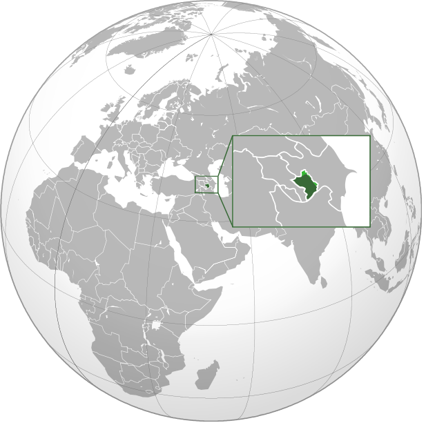
English: Orthographic Projection Map of the Nagorno-Karabakh Republic Dark Green represents areas under ethnic Armenian military control, light green represents areas claimed by the republic, under Azerbaijan government control. |
| 日期 | (UTC) |
| 来源 | |
| 作者 |
|
.svg)
| 这是一张修改过的图片,这意味着它已在原版本的基础上通过软件进行了编辑,改动内容:made the location of NKR more clear on the world map。其原始版本为:Nagorno-Karabakh Republic (orthographic projection).svg。修改者:Ashot Arzumanyan。
|
| 此作品不具有版权,属于公有领域,因为其所包含之内容均为公共财产且没有明确的原始作者信息。 |
原始上传日志
This image is a derivative work of the following images:
- File:Nagorno-Karabakh_Republic_(orthographic_projection).svg licensed with PD-ineligible
- 2010-02-23T00:53:47Z Kentronhayastan 550x550 (594491 Bytes) cleaned up the fixed borders
- 2010-02-21T11:04:39Z Dinamik 550x550 (655950 Bytes) some more information about territory
- 2010-02-12T12:42:58Z Justass 550x550 (586396 Bytes) Reverted to version as of 10:24, 27 January 2010
- 2010-02-12T12:40:31Z Maulucioni 550x550 (105958 Bytes) to png
- 2010-01-27T10:24:54Z Kentronhayastan 550x550 (586396 Bytes) adjusted map size
- 2010-01-27T10:19:16Z Kentronhayastan 550x550 (586344 Bytes) {{Information |Description={{en|1=Orthographic Projection Map of the Nagorno-Karabakh Republic}} |Source=Ssolbergj's work |Author=kentronhayastan, Ssolbergj |Date= |Permission= |other_versions= }}
Uploaded with derivativeFX
文件历史
点击某个日期/时间查看对应时刻的文件。
| 日期/时间 | 缩略图 | 大小 | 用户 | 备注 | |
|---|---|---|---|---|---|
| 当前 | 2011年1月11日 (二) 18:46 | | 617 × 613(120 KB) | Ashot Arzumanyan | {{Information |Description={{en|1=Orthographic Projection Map of the Nagorno-Karabakh Republic}} Dark Green represents areas under ethnic Armenian military control, light green represents areas claimed by the republic, under Azerbaijan government control. |
文件用途
没有页面链接到本图像。
全域文件用途
以下其他wiki使用此文件:
- en.wikipedia.org上的用途
- fa.wikipedia.org上的用途
- hy.wikipedia.org上的用途
_v1.png)