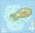
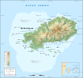
File:Rodrigues Island topographic map-de.svg
外观

此SVG文件的PNG预览的大小:637 × 600像素。 其他分辨率:255 × 240像素 | 510 × 480像素 | 816 × 768像素 | 1,088 × 1,024像素 | 2,176 × 2,048像素 | 1,700 × 1,600像素。
原始文件 (SVG文件,尺寸为1,700 × 1,600像素,文件大小:750 KB)
文件历史
点击某个日期/时间查看对应时刻的文件。
| 日期/时间 | 缩略图 | 大小 | 用户 | 备注 | |
|---|---|---|---|---|---|
| 当前 | 2008年5月14日 (三) 14:05 |  | 1,700 × 1,600(750 KB) | NordNordWest | {{Location|19|43|00|S|63|25|00|E|scale:200000}} <br/> {{Information |Description= {{de|Topografische Karte der Insel Rodrigues, Mauritius, deutsche Version<br/>Maßstab: 1:372.000 (Genauigkeit: etwa 93 m); Druck |
文件用途
没有页面链接到本图像。
全域文件用途
以下其他wiki使用此文件:
- af.wikipedia.org上的用途


