
File:Roman Empire with provinces in 210 AD.png

本预览的尺寸:800 × 551像素。 其他分辨率:320 × 221像素 | 640 × 441像素 | 1,024 × 706像素 | 1,280 × 882像素 | 2,052 × 1,414像素。
原始文件 (2,052 × 1,414像素,文件大小:247 KB,MIME类型:image/png)
文件历史
点击某个日期/时间查看对应时刻的文件。
| 日期/时间 | 缩略图 | 大小 | 用户 | 备注 | |
|---|---|---|---|---|---|
| 当前 | 2020年2月15日 (六) 20:18 | | 2,052 × 1,414(247 KB) | Trecătorul răcit | Italia, Chersonesus, some details |
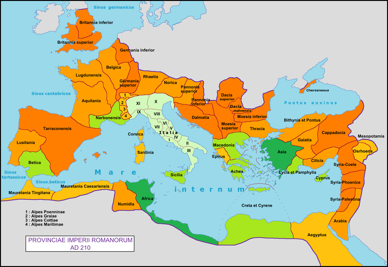
| 2009年3月10日 (二) 12:49 |  | 2,052 × 1,414(260 KB) | Mandrak | {{Information |Description={{en|1=Map of the Roman Empire with the provinces of 210 AD.}} {{fr|1=Carte de l'Empire romain avec ses provinces en 210 ap. J.-C.}} |Source=travail personnel (own work) |Author=Mandrak |Date= |Permission= |othe |
文件用途
没有页面链接到本图像。
全域文件用途
以下其他wiki使用此文件:
- de.wikibooks.org上的用途
- de.wikiversity.org上的用途
- en.wikipedia.org上的用途
- en.wiktionary.org上的用途
- es.wikipedia.org上的用途
- et.wikipedia.org上的用途
- eu.wikipedia.org上的用途
- fi.wikibooks.org上的用途
- fr.wikipedia.org上的用途
- fr.wikiversity.org上的用途
- gl.wikipedia.org上的用途
- hy.wikipedia.org上的用途
- hyw.wikipedia.org上的用途
- is.wikipedia.org上的用途
- it.wikipedia.org上的用途
- it.wikibooks.org上的用途
- lt.wikipedia.org上的用途
- pl.wikipedia.org上的用途
- sl.wikipedia.org上的用途
- tr.wikipedia.org上的用途
- uk.wikipedia.org上的用途