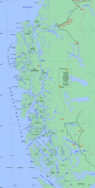
File:Sur1.gif
外观

本预览的尺寸:303 × 599像素。 其他分辨率:121 × 240像素 | 243 × 480像素 | 388 × 768像素 | 518 × 1,024像素 | 1,843 × 3,641像素。
原始文件 (1,843 × 3,641像素,文件大小:657 KB,MIME类型:image/gif)
文件历史
点击某个日期/时间查看对应时刻的文件。
| 日期/时间 | 缩略图 | 大小 | 用户 | 备注 | |
|---|---|---|---|---|---|
| 当前 | 2013年4月21日 (日) 17:44 |  | 1,843 × 3,641(657 KB) | Keysanger | canal oeste al oeste de c. concepcion. Canal Pitt en vez de C. Pia. Agrego Canal Castro |
| 2013年3月5日 (二) 17:10 |  | 1,843 × 3,641(657 KB) | Keysanger | "Estrecho Nelson" added | |
| 2013年3月5日 (二) 17:06 |  | 1,843 × 3,641(657 KB) | Keysanger | typo fixed: 74°W to 72°W | |
| 2008年8月4日 (一) 01:03 |  | 1,843 × 3,641(675 KB) | Keysanger | {{Information |Description={{en|1=Channels in South-Chile}} |Source=Own work by uploader |Author=Createaccount |Date=2008 |Permission={{GFDL-GMT}}} |other_versions= }} {{ImageUpload|full}} Category:Maps of Chile | |
| 2008年7月24日 (四) 19:28 |  | 1,824 × 3,312(586 KB) | Keysanger | {{Information |Description={{en|1=Channels in South-Chile}} |Source=Own work by uploader |Author=Createaccount |Date=2008 |Permission={{GFDL-GMT}}} |other_versions= }} {{ImageUpload|full}} Category:Maps of Chile |
文件用途
全域文件用途
以下其他wiki使用此文件:
- ar.wikipedia.org上的用途
- arz.wikipedia.org上的用途
- ast.wikipedia.org上的用途
- br.wikipedia.org上的用途
- ceb.wikipedia.org上的用途
- Canal Wide
- Isla Presidente Gabriel González Videla
- Isla Manuel Rodríguez
- Archipiélago Madre de Dios
- Isla Figueroa (pulo sa Región de Magallanes y de la Antártica Chilena, lat -50,42, long -74,67)
- Isla Evans (pulo, lat -51,29, long -74,02)
- Canal Concepción
- Isla Cochrane
- Isla Chatham (pulo sa Tśile)
- Isla Barros Arana
- Isla Armonía
- de.wikipedia.org上的用途
- en.wikipedia.org上的用途
查看此文件的更多全域用途。


