
File:Tahaa and Raiatea topographic map - with communes et communes associées.svg

此SVG文件的PNG预览的大小:374 × 599像素。 其他分辨率:150 × 240像素 | 300 × 480像素 | 480 × 768像素 | 639 × 1,024像素 | 1,279 × 2,048像素 | 714 × 1,143像素。
原始文件 (SVG文件,尺寸为714 × 1,143像素,文件大小:333 KB)
摘要
| 描述 | |
| 日期 | |
| 来源 |
Œuvre personnelle.
Données :
Logiciels utilisés :
Autres informations :
|
| 作者 | Sardon, derivative work of the original work by Maximilian Dörrbecker (Chumwa) |
| 其他版本 | Macedonian |
许可协议
| 我,本作品著作权人,释出本作品至公有领域。这适用于全世界。 在一些国家这可能不合法;如果是这样的话,那么: 我无条件地授予任何人以任何目的使用本作品的权利,除非这些条件是法律规定所必需的。 |
文件历史
点击某个日期/时间查看对应时刻的文件。
| 日期/时间 | 缩略图 | 大小 | 用户 | 备注 | |
|---|---|---|---|---|---|
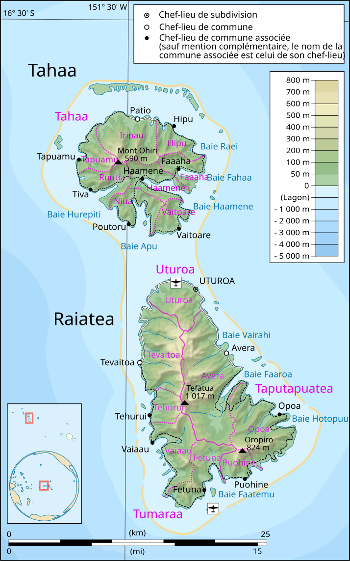
| 当前 | 2015年5月12日 (二) 06:20 | | 714 × 1,143(333 KB) | Chumwa | == {{int:filedesc}} == {{Information |Description={{en|1=Topographic map in French of the islands of Tahaa and Raiatea, Society Islands, French Polynesia.}} {{fr|1=Carte topographique en français des îles de [[:fr:Tahaa|... |
文件用途
全域文件用途
以下其他wiki使用此文件:
- de.wikipedia.org上的用途
- eo.wikipedia.org上的用途
- es.wikipedia.org上的用途
- fr.wikipedia.org上的用途
- it.wikipedia.org上的用途
- ja.wikipedia.org上的用途
- lt.wikipedia.org上的用途
- mt.wikipedia.org上的用途
- nl.wikipedia.org上的用途
- no.wikipedia.org上的用途
- oc.wikipedia.org上的用途
- pl.wikipedia.org上的用途
- pt.wikipedia.org上的用途
- ru.wikipedia.org上的用途