
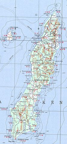
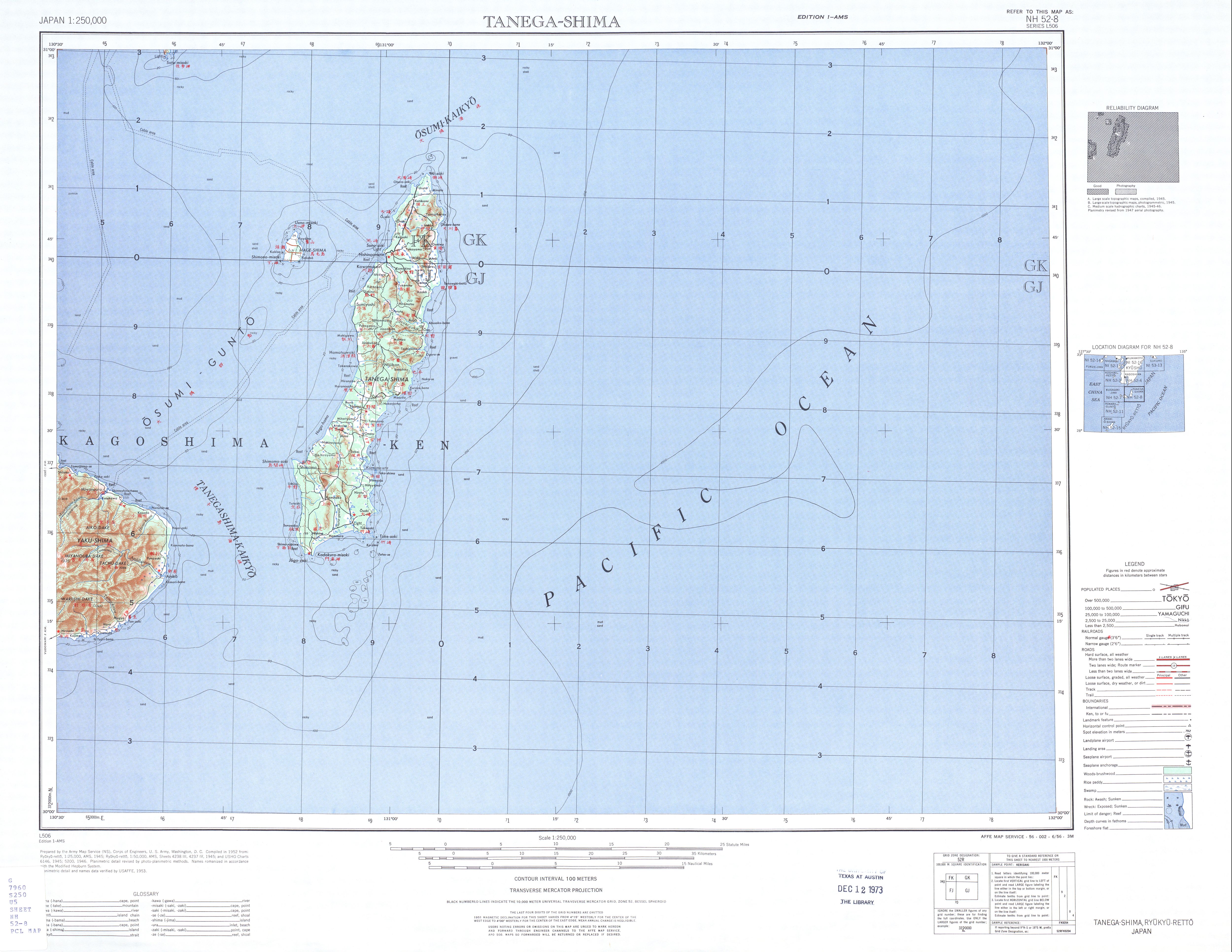
File:Tanegashima txu-oclc-6900707-nh52-8.jpg

本预览的尺寸:279 × 600像素。 其他分辨率:111 × 240像素 | 223 × 480像素 | 805 × 1,730像素。
原始文件 (805 × 1,730像素,文件大小:447 KB,MIME类型:image/jpeg)
摘要
| 描述 |
English: map sheet Tanegashima, southern Japan |
| 日期 | |
| 来源 | http://www.lib.utexas.edu/maps/ams/japan/txu-oclc-6900707-nh52-8.jpg |
| 作者 | Army Map Service, Corps of Engineers |
许可协议
|
|
 |
文件历史
点击某个日期/时间查看对应时刻的文件。
| 日期/时间 | 缩略图 | 大小 | 用户 | 备注 | |
|---|---|---|---|---|---|
| 当前 | 2012年11月20日 (二) 17:52 | | 805 × 1,730(447 KB) | Mps2 | Tanegashima extracted |
| 2010年12月11日 (六) 17:14 |  | 5,000 × 3,864(3.66 MB) | Ratzer | {{Information |Description={{en|1=map sheet Tanegashima, southern Japan}} |Source=http://www.lib.utexas.edu/maps/ams/japan/txu-oclc-6900707-nh52-8.jpg |Author=Army Map Service, Corps of Engineers |Date=1952 |Permission= |other_versions= }} [[Category:Map |
文件用途
没有页面链接到本图像。
全域文件用途
以下其他wiki使用此文件:
- az.wikipedia.org上的用途
- de.wikipedia.org上的用途
- es.wikipedia.org上的用途
- no.wikipedia.org上的用途
- pt.wikipedia.org上的用途
- ru.wikipedia.org上的用途