
File:Tatry mapa 2.png
本预览的尺寸:800 × 396像素。 其他分辨率:320 × 158像素 | 811 × 401像素。
原始文件 (811 × 401像素,文件大小:298 KB,MIME类型:image/png)
| 描述 |
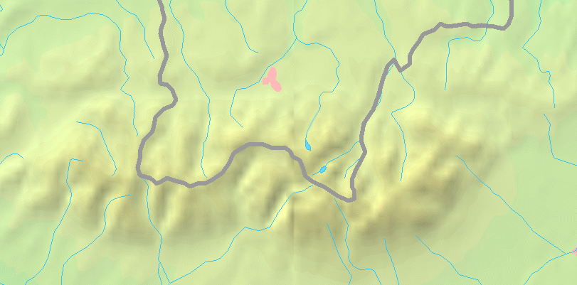
English: Map of the Tatra Mountains
Polski: Mapa Tatr |
||||
| 日期 | |||||
| 来源 | PD map from Demis - modified version of Image:Tatry mapa.png by User:Botev | ||||
| 作者 | ToSter | ||||
| 授权 (二次使用本文件) |
|
||||
| 其他版本 |
此文件衍生的作品: POL Tatry.svgImage:Tatry mapa.png
File:POL Tatry.svg:  |


文件历史
点击某个日期/时间查看对应时刻的文件。
| 日期/时间 | 缩略图 | 大小 | 用户 | 备注 | |
|---|---|---|---|---|---|
| 当前 | 2008年9月2日 (二) 21:41 | | 811 × 401(298 KB) | ToSter | {{Information |Description={{en|1=Map of the Tatra Mountains}} {{pl|1=Mapa Tatr}} |Source=PD map from Demis - modified version of Image:Tatry mapa.png by User:Botev |Author=ToSter |Date=Sep 2nd, 2008 |Permission={{PD-Demis}} |othe |
文件用途
没有页面链接到本图像。
全域文件用途
以下其他wiki使用此文件:
- cs.wikipedia.org上的用途
- pl.wikipedia.org上的用途
- Dolina Pięciu Stawów Polskich
- Dolina za Mnichem
- Dolina Suchej Wody Gąsienicowej
- Dolina Białki
- Dolina Waksmundzka
- Dolina Roztoki
- Dolina Małej Łąki
- Dolina Kieżmarska
- Dolina Jastrzębia
- Dolina Kościeliska
- Łysa Polana
- Wąwóz Kraków
- Dolina Jarząbcza
- Dolina Bystrej
- Jaworzynka (dolina)
- Dolina Kondratowa
- Żleb pod Wysranki
- Krzyż na Giewoncie
- Kamień Karłowicza
- Wysokogórskie Obserwatorium Meteorologiczne IMGW-PIB na Kasprowym Wierchu
- Bobrowiecki Żleb
- Hotarz
- Hala Jarząbcza
- Dyskusja wikipedysty:ŁukaszWu/archiwum 2
- Jaworowy Potok
- Koperszadzki Potok
- Mała Zimna Woda
- Koprowa Woda
- Ciemnosmreczyński Potok
- Kołowy Potok
- Czarny Potok Jaworowy
- Bystra (dopływ Białej Liptowskiej)
- Potok spod Kopy
- Jaszczerzycki Potok
- Mała Huczawa
- Potok Stos
- Juraniowy Potok
- Głęboki Potok (dopływ Łomnicy)
- Dyskusja wikipedysty:Mareklug/Archiwum 4
- Bobrowiecki Potok (dopływ Orawicy)
- Dzikie Siklawy
- Polana Głodówka
- Niewcyrskie Siklawy
- Reglany Potok
- Czerwony Potok (dopływ Białki)
- Litworowa Woda
- Strzystarski Potok
- Międzyścienny Potok (dopływ Jaworowego Potoku)
- Średnica (dopływ Bielskiego Potoku)
查看此文件的更多全域用途。