
File:USA territorial growth.gif

本预览的尺寸:800 × 498像素。 其他分辨率:320 × 199像素 | 640 × 398像素 | 921 × 573像素。
原始文件 (921 × 573像素,文件大小:2.01 MB,MIME类型:image/gif、循环、10帧、50秒)
摘要
| 描述 |
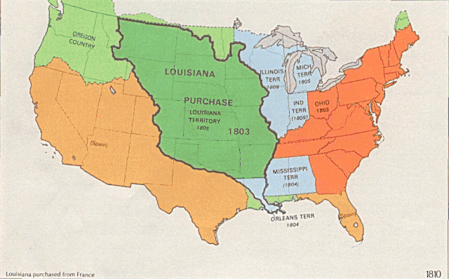
English: US territorial growth 1810–1920, based on the PD USGS maps in Category:Territorial growth maps of the United States.
See key below for explanation of colors.  |
||||||
| 来源 |
|
||||||
| 作者 |
|
||||||
| 其他版本 |
|

许可协议
|
|
文件历史
点击某个日期/时间查看对应时刻的文件。
| 日期/时间 | 缩略图 | 大小 | 用户 | 备注 | |
|---|---|---|---|---|---|
| 当前 | 2006年5月31日 (三) 01:39 | | 921 × 573(2.01 MB) | Roke~commonswiki | longer interval, 3 seconds --> 5 seconds |
| 2006年5月30日 (二) 12:21 |  | 921 × 573(2.67 MB) | Roke~commonswiki | US territorial growth 1810-1920, based on the USGS maps in commons:Category:USA Territorial Growth Maps, put together in Corel Painter IX. The individual maps have this licence: {{PD-USGov-USGS}} If it is necessary for me to licence my contributio |
文件用途
没有页面链接到本图像。
全域文件用途
以下其他wiki使用此文件:
- bn.wikipedia.org上的用途
- en.wikipedia.org上的用途
- es.wikipedia.org上的用途
- fa.wikipedia.org上的用途
- fy.wikipedia.org上的用途
- ha.wikipedia.org上的用途
- he.wikipedia.org上的用途
- nl.wikipedia.org上的用途
- pnb.wikipedia.org上的用途
- ru.wikipedia.org上的用途
- ru.wikinews.org上的用途
- sr.wikipedia.org上的用途
- tr.wikipedia.org上的用途
- ur.wikipedia.org上的用途
- uz.wikipedia.org上的用途
- www.wikidata.org上的用途