
File:US FRONTIER STRIP.PNG
此为最大尺寸。
US_FRONTIER_STRIP.PNG (572 × 371像素,文件大小:15 KB,MIME类型:image/png)
摘要
| 描述 |
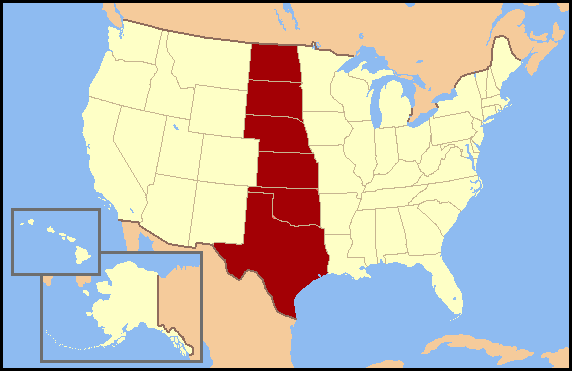
English: Frontier Strip refers to the six U.S. states from North Dakota south to Texas. These states form a nearly straight line from north to south and roughly correspond to the Great Plains region of the United States. The term Frontier Strip is probably correlated to the 1880 census, where these six states, some of which were territories at the time, were part of the "Frontier Line," the geographic designation by the U.S. Census Bureau that proclaimed where the civilitation of the Eastern United States ended and the historic American Wild West began. In the 1890 census, it stated, "Up to and including 1880 the country had a frontier of settlement, but at present the unsettled area has been so broken into by isolated bodies of settlement that there can hardly be said to be a frontier line. In the discussion of its extent, its westward movement, etc., it can not, therefore, any longer have a place in the census reports." NOTE: On 2 January 2018 Wikipedia:Articles for deletion/Frontier Strip determined that "frontier strip" is not actually a recognized geographical term, so this graphic should no longer be used. |
| 来源 | 无法识别来源。根据版权声明推断为其自己的作品。 |
| 作者 | 无法识别作者。根据版权声明推断作者为Jannizz。 |
许可协议
我,本作品著作权人,特此采用以下许可协议发表本作品:

|
已授权您依据自由软件基金会发行的无固定段落及封面封底文字(Invariant Sections, Front-Cover Texts, and Back-Cover Texts)的GNU自由文件许可协议1.2版或任意后续版本的条款,复制、传播和/或修改本文件。该协议的副本请见“GNU Free Documentation License”。 |
| 本文件采用知识共享署名-相同方式共享 3.0 未本地化版本许可协议授权。 | ||
| ||
| 本许可协议标签作为GFDL许可协议更新的组成部分被添加至本文件。 |
您可以选择您需要的许可协议。
文件历史
点击某个日期/时间查看对应时刻的文件。
| 日期/时间 | 缩略图 | 大小 | 用户 | 备注 | |
|---|---|---|---|---|---|
| 当前 | 2007年7月3日 (二) 15:43 | | 572 × 371(15 KB) | Jannizz | == Summary == Frontier Strip refers to the six U.S. states from North Dakota south to Texas. These states form a nearly straight line from north to south and roughly correspond to the Great Plains region of the United States. The term Frontier Strip i |
文件用途
以下页面使用本文件:
全域文件用途
以下其他wiki使用此文件:
- fi.wikipedia.org上的用途
- fr.wikipedia.org上的用途
- he.wikipedia.org上的用途
- ja.wikipedia.org上的用途
- no.wikipedia.org上的用途
- pt.wikipedia.org上的用途