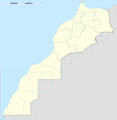
File:Western Sahara location map blank.svg
外观

此SVG文件的PNG预览的大小:677 × 600像素。 其他分辨率:271 × 240像素 | 542 × 480像素 | 867 × 768像素 | 1,156 × 1,024像素 | 2,312 × 2,048像素 | 1,472 × 1,304像素。
原始文件 (SVG文件,尺寸为1,472 × 1,304像素,文件大小:115 KB)
文件历史
点击某个日期/时间查看对应时刻的文件。
| 日期/时间 | 缩略图 | 大小 | 用户 | 备注 | |
|---|---|---|---|---|---|
| 当前 | 2019年10月21日 (一) 18:47 |  | 1,472 × 1,304(115 KB) | Sting | == {{int:filedesc}} == {{Location|24|27|00|N|12|51|00|W|scale:3000000}} {{Information |Description= {{en|Blank administrative map of {{W|Western Sahara}} without internal boundaries, for geo-location purposes.}} Equirectangular projection, WGS84 datum<br/> *Central meridian: 012° 51' W<br/> *Standard parallel: 24° 27' N<br/> Geographic limits of the map:<br/> *Top: 28° 12' N<br/> *Bottom: 20° 42' N<br/> *Left: 017° 30' W<br/> *Right: 008° 12' W |Source=[[:File:Western_Sahara_location_map.svg]... |
文件用途
没有页面链接到本图像。
全域文件用途
以下其他wiki使用此文件:
- en.wikipedia.org上的用途
- fr.wikipedia.org上的用途


