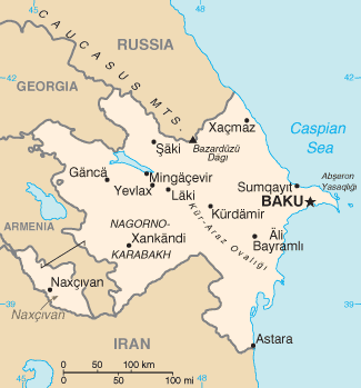
File:Aj-map.png
外观
Aj-map.png (325 × 349像素,文件大小:13 KB,MIME类型:image/png)
文件历史
点击某个日期/时间查看对应时刻的文件。
| 日期/时间 | 缩略图 | 大小 | 用户 | 备注 | |
|---|---|---|---|---|---|
| 当前 | 2022年2月19日 (六) 07:44 |  | 325 × 349(13 KB) | Lojwe | Cropped 1 % horizontally, 1 % vertically using CropTool with precise mode. |
| 2015年8月5日 (三) 12:44 |  | 328 × 352(14 KB) | Ray Garraty | Reverted to version as of 22:26, 26 February 2005 | |
| 2015年8月5日 (三) 12:11 |  | 328 × 352(43 KB) | Szczureq | Added border of Armenian-controlled Nagorno-Karabakh territory | |
| 2005年2月26日 (六) 22:26 |  | 328 × 352(14 KB) | Alfio | Cia map of Azerbaijan |
文件用途
以下6个页面使用本文件:
全域文件用途
以下其他wiki使用此文件:
- ab.wikipedia.org上的用途
- af.wikipedia.org上的用途
- ast.wikipedia.org上的用途
- av.wikipedia.org上的用途
- azb.wikipedia.org上的用途
- az.wikipedia.org上的用途
- be-tarask.wikipedia.org上的用途
- be.wikipedia.org上的用途
- bg.wikipedia.org上的用途
- bg.wiktionary.org上的用途
- br.wikipedia.org上的用途
- bs.wikipedia.org上的用途
- ca.wikipedia.org上的用途
- cs.wikipedia.org上的用途
- cv.wikipedia.org上的用途
- da.wikipedia.org上的用途
- de.wikipedia.org上的用途
- dsb.wikipedia.org上的用途
- el.wikipedia.org上的用途
- en.wikipedia.org上的用途
- Branobel
- SOCAR
- Dunsterforce
- Shah Deniz gas field
- Portal:Azerbaijan
- Portal:Azerbaijan/Azerbaijan-related topics
- Azeri–Chirag–Gunashli
- Extreme points of Azerbaijan
- Azerbaijan International Operating Company
- List of airports in Azerbaijan
- Darwin Bank
- Energy in Azerbaijan
- Karabakh oilfield
- Caspian International Petroleum Company
- Chirag oilfield
查看此文件的更多全域用途。


