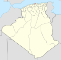
File:Algeria 35 Wilaya locator map-2009.svg
外观

此SVG文件的PNG预览的大小:508 × 500像素。 其他分辨率:244 × 240像素 | 488 × 480像素 | 780 × 768像素 | 1,040 × 1,024像素 | 2,081 × 2,048像素。
原始文件 (SVG文件,尺寸为508 × 500像素,文件大小:70 KB)
文件历史
点击某个日期/时间查看对应时刻的文件。
| 日期/时间 | 缩略图 | 大小 | 用户 | 备注 | |
|---|---|---|---|---|---|
| 当前 | 2009年11月19日 (四) 17:53 |  | 508 × 500(70 KB) | Sting | {{Information |Description={{en|Locator map of the Boumerdès Province, Algeria, as in 2009.}} {{fr|Carte de localisation de la Wilaya de Boumerdès, Algérie, telle |
文件用途
以下5个页面使用本文件:
全域文件用途
以下其他wiki使用此文件:
- ar.wikipedia.org上的用途
- be.wikipedia.org上的用途
- en.wikipedia.org上的用途
- Khemis El Khechna District
- Isser District
- Bordj Menaïel District
- Naciria District
- 2008 Beni Amrane bombings
- 2008 Issers bombing
- 2008 Thénia bombing
- 2008 Zemmouri bombing
- 2007 Souk El Had bombing
- 2005 Tidjelabine bombing
- 2010 Tidjelabine bombing
- 2006 Tidjelabine bombing
- 2006 Boudouaou bombing
- August 2010 Baghlia bombing
- 2012 Baghlia bombing
- 2008 Naciria bombing
- 2010 Bordj Menaïel bombing
- 2012 Thénia bombing
- fa.wikipedia.org上的用途
- hi.wikipedia.org上的用途
- id.wikipedia.org上的用途
- is.wikipedia.org上的用途
- pt.wikipedia.org上的用途
- ru.wikipedia.org上的用途
- simple.wikipedia.org上的用途
- sr.wikipedia.org上的用途
- sw.wikipedia.org上的用途
- uk.wikipedia.org上的用途


