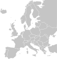
File:BlankMap-Europe.svg
外观

此SVG文件的PNG预览的大小:401 × 420像素。 其他分辨率:229 × 240像素 | 458 × 480像素 | 733 × 768像素 | 978 × 1,024像素 | 1,955 × 2,048像素。
原始文件 (SVG文件,尺寸为401 × 420像素,文件大小:100 KB)
文件历史
点击某个日期/时间查看对应时刻的文件。
| 日期/时间 | 缩略图 | 大小 | 用户 | 备注 | |
|---|---|---|---|---|---|
| 当前 | 2007年2月24日 (六) 23:35 |  | 401 × 420(100 KB) | NielsF | fixed Baltic countries |
| 2006年8月4日 (五) 08:30 |  | 401 × 420(102 KB) | LivingShadow | ||
| 2006年8月2日 (三) 21:18 |  | 401 × 420(100 KB) | LivingShadow | {{Information| |Description=(Original) The list of independent states pictured on the map (<sup>source</sup>): Albania, Andorra, Austria, Belarus, Belgium, Bosnia and Herzegovina, Bulgaria, Croatia, Czech Republic, Cyprus |
文件用途
没有页面使用本文件。
全域文件用途
以下其他wiki使用此文件:
- de.wikipedia.org上的用途
- en.wikipedia.org上的用途
- fi.wikipedia.org上的用途
- fr.wikipedia.org上的用途
- sl.wikipedia.org上的用途
- uk.wikipedia.org上的用途


