
File:Cook-1777.jpg
本预览的尺寸:800 × 560像素。 其他分辨率:320 × 224像素 | 640 × 448像素 | 1,024 × 717像素 | 1,269 × 888像素。
原始文件 (1,269 × 888像素,文件大小:539 KB,MIME类型:image/jpeg)
摘要
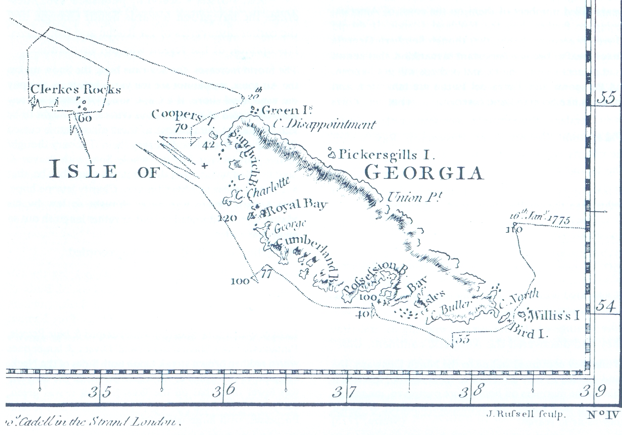
James Cook, Chart of the Discoveries made in the South Atlantic Ocean, in His Majestys Ship Resolution, under the Command of Captain Cook, in January 1775, W. Strahan and T. Cadel, London, 1777 (fragment)

|
本文件已被Cook-1777.PNG取代。建议您使用其他文件。请注意,删除被取代的图片需要达成一致。
|

|
许可协议
|
本作品在其来源国以及其他著作权期限是作者逝世后70年或以下的国家和地区属于公有领域。 | |
| 本文件已被确认为免除已知的著作权法限制(包括所有相关权利)。 | |
文件历史
点击某个日期/时间查看对应时刻的文件。
| 日期/时间 | 缩略图 | 大小 | 用户 | 备注 | |
|---|---|---|---|---|---|
| 当前 | 2006年5月6日 (六) 19:21 | | 1,269 × 888(539 KB) | Apcbg | James Cook, Chart of the Discoveries made in the South Atlantic Ocean, in His Majestys Ship Resolution, under the Command of Captain Cook, in January 1775, W. Strahan and T. Cadel, London, 1777 (fragment) |
文件用途
全域文件用途
以下其他wiki使用此文件:
- ang.wikipedia.org上的用途
- ar.wikipedia.org上的用途
- ast.wikipedia.org上的用途
- az.wikipedia.org上的用途
- bg.wikipedia.org上的用途
- bn.wikipedia.org上的用途
- ca.wikipedia.org上的用途
- ceb.wikipedia.org上的用途
- cs.wikipedia.org上的用途
- cv.wikipedia.org上的用途
- de.wikipedia.org上的用途
- en.wikipedia.org上的用途
- en.wikivoyage.org上的用途
- eo.wikipedia.org上的用途
- es.wikipedia.org上的用途
- eu.wikipedia.org上的用途
- fr.wikipedia.org上的用途
- gl.wikipedia.org上的用途
- hu.wikipedia.org上的用途
- hy.wikipedia.org上的用途
- it.wikipedia.org上的用途
查看此文件的更多全域用途。