File:Curzon line en.svg
外观

此SVG文件的PNG预览的大小:563 × 513像素。 其他分辨率:263 × 240像素 | 527 × 480像素 | 843 × 768像素 | 1,124 × 1,024像素 | 2,248 × 2,048像素。
原始文件 (SVG文件,尺寸为563 × 513像素,文件大小:243 KB)
文件历史
点击某个日期/时间查看对应时刻的文件。
| 日期/时间 | 缩略图 | 大小 | 用户 | 备注 | |
|---|---|---|---|---|---|
| 当前 | 2017年11月17日 (五) 12:36 |  | 563 × 513(243 KB) | Nicolay Sidorov | fix |
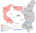
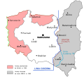
| 2007年2月26日 (一) 18:53 |  | 563 × 513(69 KB) | Radek.s | == Summary == {{Information |Description= {{pl|Mapa przedstawiająca Polskę oraz Linię Curzona (Druga Wojna Światowa). Wersja z angielskimi napisami.}} {{en|A map presenting Poland and the Curzon Line (World War II). Version with English labels.}} |S |
文件用途
全域文件用途
以下其他wiki使用此文件:
- af.wikipedia.org上的用途
- an.wikipedia.org上的用途
- ar.wikipedia.org上的用途
- azb.wikipedia.org上的用途
- az.wikipedia.org上的用途
- be.wikipedia.org上的用途
- bg.wikipedia.org上的用途
- ca.wikipedia.org上的用途
- da.wikipedia.org上的用途
- de.wikipedia.org上的用途
- el.wikipedia.org上的用途
- en.wikipedia.org上的用途
- History of Poland
- Molotov–Ribbentrop Pact
- Polish language
- Potsdam Conference
- Voivodeships of Poland
- Flight and expulsion of Germans (1944–1950)
- George Curzon, 1st Marquess Curzon of Kedleston
- Curzon Line
- Republic of Central Lithuania
- Ukrainian Soviet Socialist Republic
- Kresy
- Territorial changes of Poland immediately after World War II
- Zygmunt Wojciechowski
- Ukrainian Insurgent Army
- History of Poland (1945–1989)
- Pacification actions in German-occupied Poland
- List of irredentist claims or disputes
- Territorial evolution of Poland
- Borders of Poland
- Russia–United Kingdom relations
- Recovered Territories
- Talk:Flight and expulsion of Germans (1944–1950)/Archive 15
- Oder–Neisse line
- World War II reparations
查看此文件的更多全域用途。


