
File:IranWestAzerbaijan.png
本预览的尺寸:648 × 599像素。 其他分辨率:260 × 240像素 | 519 × 480像素 | 879 × 813像素。
原始文件 (879 × 813像素,文件大小:25 KB,MIME类型:image/png)
许可协议
| 本文件采用知识共享署名-相同方式共享 3.0 未本地化版本许可协议授权。 受免責聲明的約束。 | ||
| ||
| 本许可协议标签作为GFDL许可协议更新的组成部分被添加至本文件。 |

|
已授权您依据自由软件基金会发行的无固定段落及封面封底文字(Invariant Sections, Front-Cover Texts, and Back-Cover Texts)的GNU自由文件许可协议1.2版或任意后续版本的条款,复制、传播和/或修改本文件。该协议的副本请见“GNU Free Documentation License”。 受免責聲明的約束。 |

|
本文件已被IranWestAzerbaijan-SVG.svg取代。建议您使用其他文件。请注意,删除被取代的图片需要达成一致。
|

|
| 描述 |
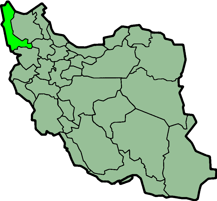
Province of West Azarbayjan, Iran Deutsch: Lage der Provinz West Aserbaidschan im Iran
Nederlands: Locatie van West Azarbaijan |
| 日期 | (UTC) |
| 来源 | http://en.wikipedia.org/wiki/Image:IranWestAzerbaijan.png |
| 作者 | Morven |
| 授权 (二次使用本文件) |
GFDL |
文件历史
点击某个日期/时间查看对应时刻的文件。
| 日期/时间 | 缩略图 | 大小 | 用户 | 备注 | |
|---|---|---|---|---|---|
| 当前 | 2013年6月24日 (一) 00:20 | | 879 × 813(25 KB) | BasilLeaf | بروزرسانی مرز بین استانهای یزد و خراسان جنوبی، تهران و البرز، فارس و یزد و اصفهان |
| 2010年11月12日 (五) 12:07 |  | 879 × 813(41 KB) | M samadi | Quality improved, Border of some provinces updated. | |
| 2010年10月13日 (三) 12:38 |  | 200 × 185(13 KB) | Amin19850 | Tehran & Alborz Province is divided | |
| 2009年10月4日 (日) 07:49 |  | 200 × 185(11 KB) | Alborz Fallah | Reverted to version as of 21:18, 8 November 2006 | |
| 2009年9月27日 (日) 23:25 |  | 895 × 823(9 KB) | Ladsgroup | Better image from file:Blank-Map-Iran-With-Water-Bodies | |
| 2006年11月8日 (三) 21:18 |  | 200 × 185(11 KB) | Raymond | transparent background, improved color palette | |
| 2005年9月6日 (二) 06:18 |  | 200 × 185(22 KB) | Roozbeh | updated with new Khorasan(s) and expandion of Yazd | |
| 2005年9月6日 (二) 03:00 |  | 200 × 185(20 KB) | Kotoito | Province of ٌWest Azarbayjan, Iran Created by Morwen |
文件用途
没有页面使用本文件。
全域文件用途
以下其他wiki使用此文件:
- ar.wikipedia.org上的用途
- ca.wikipedia.org上的用途
- ceb.wikipedia.org上的用途
- ckb.wikipedia.org上的用途
- da.wikipedia.org上的用途
- el.wikipedia.org上的用途
- en.wikipedia.org上的用途
- Poldasht
- Batchi
- Sumay-ye Beradust District
- Qarna
- List of Assyrian settlements
- Margavar Rural District
- Targavar Rural District
- Bahik
- Shatman
- Aghasur
- Urmia Shahid Bakeri International Airport
- Siah Cheshmeh
- Bozgush
- Chaku
- Churs
- User:AlexNebraska/Images of Iran
- Baltan
- Showt
- Barbin
- Kaput
- Halaj
- Dalikdash
- Keshtaz
- Silvaneh District
- Silvaneh
- Abajaluy-e Sofla
- Abarabashi
- Adaghan
- Agh Gol
- Aghbolagh-e Chamanlu
- Aghbolagh-e Mokhur
- Aghcheh Qaleh
- Agheshlu
- Aghsaqal
- Aghutman
- Firuraq
- Ivughli
- Avajiq
- Qarah Zia od Din
- Yushanlu, West Azerbaijan
- Serow, Iran
- Nalus
- Yasinabad
查看本文件的更多全域用途。