
File:Camp Fire oli 2018312 Landsat.jpg
本预览的尺寸:800 × 533像素。 其他分辨率:320 × 213像素 | 640 × 427像素 | 1,024 × 683像素 | 1,280 × 853像素 | 3,017 × 2,011像素。
原始文件 (3,017 × 2,011像素,文件大小:1.28 MB,MIME类型:image/jpeg)
摘要
| 描述 |
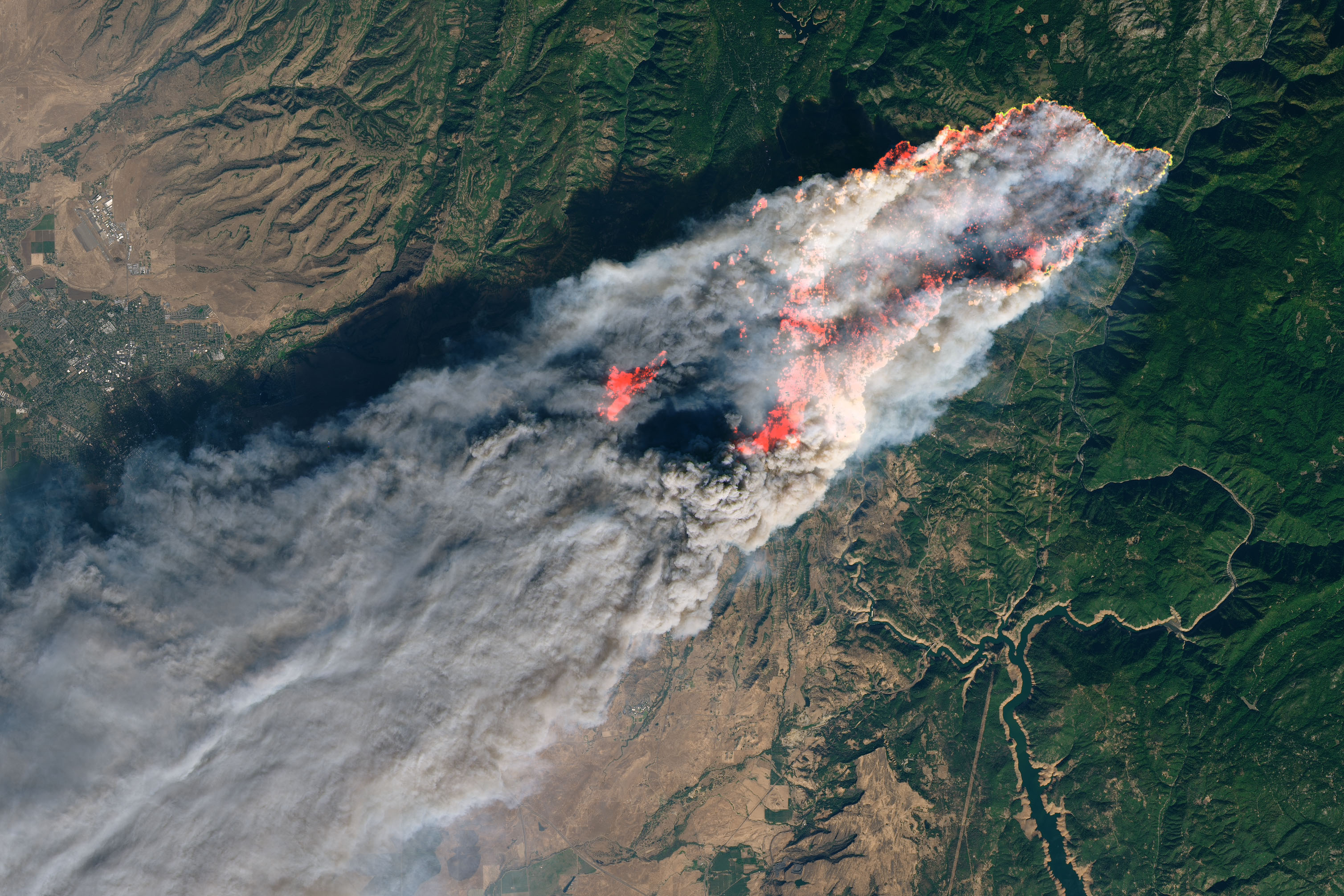
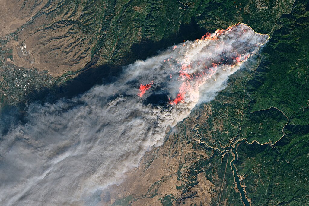
English: On the morning of November 8, 2018, the Camp Fire erupted 90 miles (140 kilometers) north of Sacramento, California. By evening, the fast-moving fire had charred around 18,000 acres and remained zero percent contained, according to news reports.
The Operational Land Imager on Landsat 8 acquired this image on November 8, 2018, around 10:45 a.m. local time (06:45 Universal Time). The natural-color image was created using bands 4-3-2, along with shortwave infrared light to highlight the active fire. Officials evacuated several towns, including Paradise. They also closed several major highways. |
| 日期 | UT |
| 来源 | https://earthobservatory.nasa.gov/images/144225/camp-fire-rages-in-california |
| 作者 | NASA, Joshua Stevens |
许可协议
| 本文件完全由NASA创作,在美国属于公有领域。根据NASA的版权方针,NASA的材料除非另有声明否则不受版权保护。(参见Template:PD-USGov/zh、NASA版权方针页面或JPL图片使用方针。) | ||
 |
警告:
|
文件历史
点击某个日期/时间查看对应时刻的文件。
| 日期/时间 | 缩略图 | 大小 | 用户 | 备注 | |
|---|---|---|---|---|---|
| 当前 | 2018年11月9日 (五) 17:46 | | 3,017 × 2,011(1.28 MB) | Sevgonlernassau | User created page with UploadWizard |
文件用途
以下页面使用本文件:
全域文件用途
以下其他wiki使用此文件:
- cs.wikipedia.org上的用途
- de.wikipedia.org上的用途
- en.wikipedia.org上的用途
- es.wikinews.org上的用途
- fa.wikipedia.org上的用途
- fi.wikipedia.org上的用途
- fi.wikinews.org上的用途
- fr.wikipedia.org上的用途
- he.wikipedia.org上的用途
- it.wikinews.org上的用途
- nl.wikipedia.org上的用途
- nl.wikinews.org上的用途
- no.wikipedia.org上的用途
- ru.wikipedia.org上的用途
- simple.wikipedia.org上的用途
- www.wikidata.org上的用途