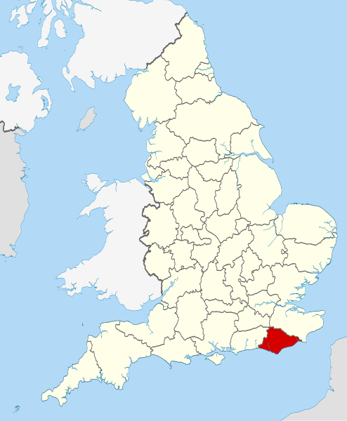
File:East Sussex UK locator map 2010.svg
外观

此SVG文件的PNG预览的大小:494 × 600像素。 其他分辨率:198 × 240像素 | 395 × 480像素 | 633 × 768像素 | 843 × 1,024像素 | 1,687 × 2,048像素 | 1,108 × 1,345像素。
原始文件 (SVG文件,尺寸为1,108 × 1,345像素,文件大小:302 KB)
文件历史
点击某个日期/时间查看对应时刻的文件。
| 日期/时间 | 缩略图 | 大小 | 用户 | 备注 | |
|---|---|---|---|---|---|
| 当前 | 2010年11月23日 (二) 22:35 |  | 1,108 × 1,345(302 KB) | Nilfanion | == Summary == {{Information |Description=Location of the ceremonial county of East Sussex within England. |Source=Ordnance Survey [https://www.ordnancesurvey.co.uk/opendatadownload/products.html OpenData]: *County b |
文件用途
以下页面使用本文件:
全域文件用途
以下其他wiki使用此文件:
- af.wikipedia.org上的用途
- ar.wikipedia.org上的用途
- ast.wikipedia.org上的用途
- be-tarask.wikipedia.org上的用途
- bg.wikipedia.org上的用途
- ca.wikipedia.org上的用途
- ceb.wikipedia.org上的用途
- cs.wikipedia.org上的用途
- dag.wikipedia.org上的用途
- en.wikipedia.org上的用途
- East Sussex
- Cliffe Hill
- Upper Hartfield
- Icklesham
- Withdean
- Fletching, East Sussex
- Dallington, East Sussex
- East Guldeford
- Iden, East Sussex
- Playden
- Rye Foreign
- Udimore
- Little Horsted
- Wartling
- St Ann Without
- Preston, Brighton
- Denton, East Sussex
- Chailey Common
- Newhaven Seaplane Base
- Lullington, East Sussex
- East Blatchington
- Darwell Reservoir
- Winchelsea Beach
- Plumpton Racecourse
- River Uck
- Ridgewood, East Sussex
- Template:EastSussex-geo-stub
- Hove Park
- Sussex Ouse Valley Way
- Baldslow
- Belmont, East Sussex
- Rock-a-Nore
- Gensing, East Sussex
- Broad Oak, Wealden
- Salehurst and Robertsbridge
- Sidley, East Sussex
- West Hill, Brighton
- Rye Harbour SSSI
查看此文件的更多全域用途。


