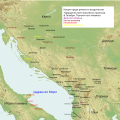
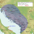
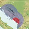
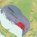
File:Illyrian Tribes (English).svg

此SVG文件的PNG预览的大小:600 × 600像素。 其他分辨率:240 × 240像素 | 480 × 480像素 | 768 × 768像素 | 1,024 × 1,024像素 | 2,048 × 2,048像素 | 1,600 × 1,600像素。
原始文件 (SVG文件,尺寸为1,600 × 1,600像素,文件大小:8.57 MB)
文件历史
点击某个日期/时间查看对应时刻的文件。
| 日期/时间 | 缩略图 | 大小 | 用户 | 备注 | |
|---|---|---|---|---|---|
| 当前 | 2022年7月23日 (六) 16:52 |  | 1,600 × 1,600(8.57 MB) | Khirurg | more minor fixes |
| 2022年7月23日 (六) 16:22 |  | 1,600 × 1,600(8.56 MB) | Khirurg | More fixes | |
| 2022年7月23日 (六) 15:08 | 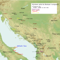 | 1,600 × 1,600(8.57 MB) | Khirurg | Fixes | |
| 2016年6月25日 (六) 09:34 |  | 1,600 × 1,600(8.57 MB) | MaryroseB54 | Paionia text position | |
| 2016年6月23日 (四) 00:11 |  | 1,600 × 1,600(8.57 MB) | MaryroseB54 | The Illyrian Atintani, the Epirotic Atintanes and the Roman Protectorate N. G. L. Hammond, The Journal of Roman Studies Vol. 79 (1989), pp. 11-25 "There were Illyrian Amantini in Pannonia and Greek Amantes in North Epirus" | |
| 2016年6月22日 (三) 21:48 |  | 1,600 × 1,600(8.57 MB) | MaryroseB54 | position | |
| 2016年6月22日 (三) 19:49 |  | 1,600 × 1,600(8.57 MB) | MaryroseB54 | Placed Byllis, 25 kilometers from the sea | |
| 2016年6月22日 (三) 14:06 |  | 1,600 × 1,600(8.57 MB) | MaryroseB54 | 3 Cities in order to make sense of the locations | |
| 2016年6月19日 (日) 10:18 |  | 1,600 × 1,600(8.57 MB) | MaryroseB54 | Corrected position of 2 tribes | |
| 2016年6月17日 (五) 11:49 |  | 1,600 × 1,600(8.57 MB) | MaryroseB54 | User created page with UploadWizard |
文件用途
全域文件用途
以下其他wiki使用此文件:
- an.wikipedia.org上的用途
- ar.wikipedia.org上的用途
- az.wikipedia.org上的用途
- be.wikipedia.org上的用途
- bg.wikipedia.org上的用途
- bn.wikipedia.org上的用途
- bs.wikipedia.org上的用途
- ca.wikipedia.org上的用途
- cs.wikipedia.org上的用途
- da.wikipedia.org上的用途
- en.wikipedia.org上的用途
- eo.wikipedia.org上的用途
- fa.wikipedia.org上的用途
- fy.wikipedia.org上的用途
- gl.wikipedia.org上的用途
- he.wikipedia.org上的用途
- hr.wikipedia.org上的用途
- hy.wikipedia.org上的用途
- id.wikipedia.org上的用途
- it.wikipedia.org上的用途
- ja.wikipedia.org上的用途
- ja.wikibooks.org上的用途
- ka.wikipedia.org上的用途
- kk.wikipedia.org上的用途
- ko.wikipedia.org上的用途
- lt.wikipedia.org上的用途
- lv.wikipedia.org上的用途
- mg.wikipedia.org上的用途
- nl.wikipedia.org上的用途
- no.wikipedia.org上的用途
- nrm.wikipedia.org上的用途
查看本文件的更多全域用途。


