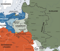
File:Karte kongresspolen.png
外观

本预览的尺寸:701 × 599像素。 其他分辨率:281 × 240像素 | 562 × 480像素 | 896 × 766像素。
原始文件 (896 × 766像素,文件大小:621 KB,MIME类型:image/png)
文件历史
点击某个日期/时间查看对应时刻的文件。
| 日期/时间 | 缩略图 | 大小 | 用户 | 备注 | |
|---|---|---|---|---|---|
| 当前 | 2024年7月28日 (日) 19:12 |  | 896 × 766(621 KB) | OrionNimrod | Restore original. If this is Österreich-Ungarn (Austria-Hungary) which estbalished in 1867, Transylvania was integral part of Hungary. Zygiel want all the time remove Transylvania from Hungary in historical maps, example: https://cdn.imgpile.com/f/Lqa6lXu_xl.jpg > https://commons.wikimedia.org/wiki/Commons:Deletion_requests/File:Europe_1097-corrected.jpg |
| 2024年4月5日 (五) 11:47 |  | 896 × 766(602 KB) | Claude Zygiel | The original is incorrect because it represents Austria-Hungary which was not founded until 1867, while Congress Poland was created in 1815 at the Congress of Vienna. It would be better to avoid being obsessed with Transylvania which has nothing to do with this. Julieta, Zygiel (who are not blocked) absolutely do not want to "remove" Transylvania nor separate it from Hungary in historical maps but on the contrary to represent it (knowing perfectly well that it was ruled by the Hungarian nobil... | |
| 2024年2月16日 (五) 15:46 |  | 896 × 766(621 KB) | OrionNimrod | Restore original. If this is Österreich-Ungarn (Austria-Hungary) which estbalished in 1867, Transylvania was integral part of Hungary, and I do not see other county borders. Blocked Julieta and Zygiel want all the time remove Transylvania from Hungary in historical maps by Romanian nationalistic purpose, example: https://commons.wikimedia.org/wiki/Commons:Deletion_requests/File:Europe_1097-corrected.jpg | |
| 2024年1月13日 (六) 09:41 |  | 896 × 766(602 KB) | Claude Zygiel | This is not a master painting or an artist's photo. It is a digital map of history and it would be desirable to stop restoring erroneous versions. At least read the talk page, it was created for that. | |
| 2022年11月16日 (三) 16:22 |  | 900 × 770(442 KB) | Gyalu22 | Other countries also don't have administrative division borders | |
| 2022年6月8日 (三) 18:25 |  | 896 × 766(602 KB) | Claude Zygiel | Reverted to version as of 23:17, 15 October 2016 (UTC) : please see Discussion file. | |
| 2021年4月7日 (三) 22:40 |  | 900 × 770(442 KB) | JohnVanVliet | jpg artifact removal | |
| 2016年10月15日 (六) 23:17 |  | 896 × 766(602 KB) | The Real The Z | Wiederherstellung des ẞ (großen Eszetts) in der Karte. Die vorherige Version ersetzte das ẞ mit einem ß, obwohl es bei diesem Upload darum geht, dass die Karte ein ẞ enthält, und nicht ein SS/SZ/ß. | |
| 2016年10月15日 (六) 05:49 |  | 1,344 × 1,149(494 KB) | Jiangkm3 | Higher Resolution | |
| 2016年5月6日 (五) 14:34 |  | 896 × 766(602 KB) | Julieta39 | Kleine kosmetische Hinzufügen |
文件用途
以下2个页面使用本文件:
全域文件用途
以下其他wiki使用此文件:
- als.wikipedia.org上的用途
- an.wikipedia.org上的用途
- ast.wikipedia.org上的用途
- bat-smg.wikipedia.org上的用途
- be-tarask.wikipedia.org上的用途
- be.wikipedia.org上的用途
- br.wikipedia.org上的用途
- ca.wikipedia.org上的用途
- cs.wikipedia.org上的用途
- da.wikipedia.org上的用途
- de.wikipedia.org上的用途
- en.wikipedia.org上的用途
- eo.wikipedia.org上的用途
- es.wikipedia.org上的用途
- et.wikipedia.org上的用途
- fr.wikipedia.org上的用途
- gl.wikipedia.org上的用途
- he.wikipedia.org上的用途
- hr.wikipedia.org上的用途
- hu.wikipedia.org上的用途
- it.wikipedia.org上的用途
- ka.wikipedia.org上的用途
- lt.wikibooks.org上的用途
- lv.wikipedia.org上的用途
查看此文件的更多全域用途。


