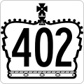
File:Ontario 402 crown.svg
外观

此SVG文件的PNG预览的大小:600 × 600像素。 其他分辨率:240 × 240像素 | 480 × 480像素 | 768 × 768像素 | 1,024 × 1,024像素 | 2,048 × 2,048像素 | 601 × 601像素。
原始文件 (SVG文件,尺寸为601 × 601像素,文件大小:21 KB)
文件历史
点击某个日期/时间查看对应时刻的文件。
| 日期/时间 | 缩略图 | 大小 | 用户 | 备注 | |
|---|---|---|---|---|---|
| 当前 | 2019年4月19日 (五) 01:42 |  | 601 × 601(21 KB) | Fredddie | redrawn |
| 2010年1月31日 (日) 23:29 |  | 289 × 289(8 KB) | Floydian | {{Information |Description=This is a rough approximation of the junction marker used on King's Highways in Ontario. |Source=modified from Image:Ontario Junction template.svg |Date= |Author=NE2 |Permission= |other_versions= }} {{PD-inelig |
文件用途
没有页面使用本文件。
全域文件用途
以下其他wiki使用此文件:
- en.wikipedia.org上的用途
- Interstate 94
- Interstate 69
- Ontario Highway 401
- St. Clair River
- Blue Water Bridge
- Lambton County
- Ontario Highway 4
- Ontario Highway 2
- Ontario Highway 21
- Ontario Highway 40
- List of Canada–United States border crossings
- Interstate 94 in Michigan
- Interstate 69 in Michigan
- List of Ontario provincial highways
- Wonderland Road
- User:Floydian/RTL
- User:Floydian/Daily check
- Ontario Highway 81
- Port Huron–Sarnia Border Crossing
- User:Cilabsuhsk/sandbox
- List of bridges documented by the Historic American Engineering Record in Michigan
- fr.wikipedia.org上的用途
- simple.wikipedia.org上的用途

