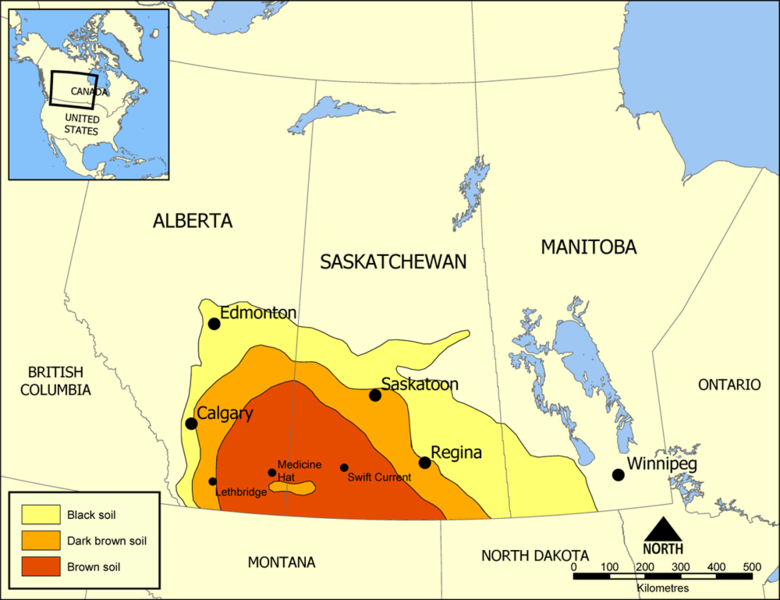
File:Palliser's Triangle map.png
外观

本预览的尺寸:780 × 600像素。 其他分辨率:312 × 240像素 | 624 × 480像素 | 1,000 × 769像素。
原始文件 (1,000 × 769像素,文件大小:301 KB,MIME类型:image/png)
文件历史
点击某个日期/时间查看对应时刻的文件。
| 日期/时间 | 缩略图 | 大小 | 用户 | 备注 | |
|---|---|---|---|---|---|
| 当前 | 2005年7月18日 (一) 15:50 |  | 1,000 × 769(301 KB) | NormanEinstein | Map showing the extent of Palliser's Triangle in Western Canada. The area covers parts of Alberta, Saskatchewan, and Manitoba and is notable for its lack of trees. The lack of sturdy vegetation devastated the area during the Dust Bowl of the 1930s, but mo |
文件用途
以下页面使用本文件:
全域文件用途
以下其他wiki使用此文件:
- ca.wikipedia.org上的用途
- cs.wikipedia.org上的用途
- cv.wikipedia.org上的用途
- de.wikipedia.org上的用途
- en.wikipedia.org上的用途
- es.wikipedia.org上的用途
- fr.wikipedia.org上的用途
- la.wikipedia.org上的用途
- pt.wikipedia.org上的用途
- ru.wikipedia.org上的用途
- uk.wikipedia.org上的用途
- www.wikidata.org上的用途


