恩迪拉維島
外觀
| Endelave Island | |
|---|---|
| 島 | |
 The island of Endelave seen from the north east | |
| 坐標:55°45′0″N 10°18′0″E / 55.75000°N 10.30000°E | |
| 國家 | |
| 市鎮 | 霍森斯市鎮 |
| 面積 | |
| • 總計 | 13.2 平方公里(5.1 平方英里) |
| 人口(2011) | |
| • 總計 | 185人 |
| • 密度 | 14人/平方公里(36.3人/平方英里) |
| 時區 | CET(UTC+1) |
| • 夏時制 | CEST(UTC+2) |
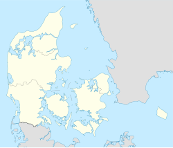
恩迪拉維島(丹麥語:Endelave)是丹麥的島嶼,位於薩姆斯島以西的卡特加特海峽上,距離日德蘭半島10公里,由中日德蘭大區負責管轄,長6.7公里、寬2.4公里,面積13.2平方公里,2011年人口185。
參考資料
[編輯]- ^ Horsens Fjord and Endelave. Ramsar Sites Information Service. [25 April 2018]. (原始內容存檔於2023-04-01).
| 這是一篇丹麥地理小作品。您可以透過編輯或修訂擴充其內容。 |

