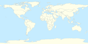
模板:Infobox mine/doc
外觀
使用方法
[編輯]| {{{name}}} | |
|---|---|
| [[File:{{{image}}}|{{{width}}}]] {{{caption}}} | |
| 位置 | |
| 國家 | {{{country}}} |
| {{{subdivision_type}}} | {{{state/province}}} |
| 位置 | {{{place}}} |
| 產量 | |
| 產出物 | {{{products}}} |
| 產量 | {{{amount}}} |
| 年度 | {{{financial year}}} |
| 類型 | {{{type}}} |
| 最深處 | {{{greatest depth}}} |
| 歷史 | |
| 開採 | {{{opening year}}} |
| 挖掘時間 | {{{active years}}} |
| 停採 | {{{closing year}}} |
| {{{nrhp}}} | |
| 擁有者 | |
| 業主 | {{{owner}}} |
| 網站 | {{{official website}}} |
| 併購年份 | {{{acquisition year}}} |
| Superfund site | |
| {{{superfund}}} | |
{{Infobox mine
|name             =
|image            =
|width            =
|caption          =
<!-- 位置 -->
|pushpin_map      =
|pushpin_label_position =
|pushpin_label    =
|pushpin_map_alt  =
|pushpin_mapsize  =
|pushpin_image    =
|pushpin_map_caption =
|latd = |latm = |lats = |latNS = <!-- 緯度(度、分、秒、南北緯) -->
|longd = |longm = |longs = |longEW = <!-- 經度(度、分、秒、東西經) -->
|coordinates_type =
|scale            =
|coordinates_region =
|display          =
|location         =
|place            = <!-- 所在位置 -->
|subdivision_type =
|state/province   =
|country          = <!-- 國家 -->
<!-- 擁有者 -->
|owner            = <!-- 業主 -->
|official website = <!-- 官方網站 -->
|acquisition year = <!-- 併購年份 -->
|stock_exchange   =
|stock_code       =
<!-- 產量 -->
|products         = <!-- 產出物 -->
|amount           = <!-- 產量 -->
|financial year   = <!-- 年度 -->
|greatest depth   = <!-- 最深處 -->
<!-- 歷史 -->
|opening year     = <!-- 開採年份 -->
|active years     = <!-- 挖掘時間 -->
|closing year     = <!-- 停採年份 -->
}}
範例
[編輯]| XX礦場 | |
|---|---|
| 位置 | |
| 國家 | (國家名稱) |
| 位置 | XX省XX縣XX鄉 |
| 座標 | 30°00′00″N 110°00′00″E / 30.00000°N 110.00000°E |
| 產量 | |
| 產出物 | 金礦 |
| 產量 | XX萬公噸 |
| 年度 | 2000年 |
| 類型 | 地下礦場 |
| 最深處 | (最深處) |
| 歷史 | |
| 開採 | 1900年 |
| 挖掘時間 | 115年 |
| 停採 | 2015年 |
| 擁有者 | |
| 業主 | XXXX公司 |
| 網站 | www |
| 併購年份 | 2010年 |
{{Infobox mine
| name               = XX礦場
| image              = example.jpg
| width              =
| caption            = XX礦場
| pushpin_map        = World
| pushpin_mapsize    = 300px
| pushpin_map_alt    =
| pushpin_map_caption=
| pushpin_image      =
| pushpin_label      =
| pushpin_label_position =
| latd  =  30 | latm  =00 | lats  =00 | latNS  = N
| longd = 110 | longm = 00| longs =00 | longEW = E
| coordinates_type   =
| scale              =
| coordinates_region =
| place              = XX省XX縣XX鄉
| subdivision_type   =
| state/province     =
| country            = (國家名稱)
| products           = 金礦
| amount             = XX萬公噸
| financial year     = 2000年
| type               = 地下礦場
| greatest depth     = (最深處)
| opening year       = 1900年
| active years       = 115年
| closing year       = 2015年
| owner              = XXXX公司
| official website   = {{URL|http://www.example.com}}
| acquisition year   = 2010年
| stock_exchange     =
| stock_code         =
| nrhp               =
| superfund          =
}}
參數
[編輯]| 參數 | 內容 | 預設值 | 說明 |
|---|---|---|---|
| name | 礦山或礦場的名稱 | ||
| official_name | |||
| image | 礦山或礦場的圖片 | ||
| width | 220px | ||
| caption | 圖片描述 | ||
| pushpin_map | 可對照Category:地理位置圖模板 | ||
| pushpin_label_position | |||
| pushpin_label | |||
| pushpin_map_alt | |||
| pushpin_mapsize | |||
| pushpin_image | |||
| pushpin_map_caption | |||
| latd、latm、lats、latNS | 緯度(分別為度、分、秒、南北緯) | ||
| longd、longm、longs、longEW | 經度(分別為度、分、秒、東西經) | ||
| coordinates_type | |||
| scale | |||
| coordinates_region | |||
| display | 座標表示(inline、title、inline,title) | ||
| location | |||
| place | 所在位置 | 礦山或礦場所在的行政區 | |
| subdivision_type | |||
| state/province | |||
| country | 國家 | 可對照Wikipedia:國家及地區標示模板 | |
| owner | 業主 | ||
| official website | 網站 | 業主的官方網站 | |
| acquisition year | 併購年份 | 礦山或礦場何時被業主併購、收購或購入 | |
| stock_exchange | |||
| stock_code | |||
| products | 產出物 | ||
| amount | 產量 | 礦山或礦場之產量數據 | |
| financial year | 年度 | 礦山或礦場之產量數據所引用的年份 | |
| greatest depth | 最深處 | ||
| opening year | 開採 | 礦山或礦場開始挖掘的時間 | |
| active years | 挖掘時間 | ||
| closing year | 停採 | 礦山或礦場停止挖掘的時間 |
相關連結
[編輯]

