
File:Map of Pyongyang - 1946 - Yanggak Bridge.png

預覽大小:758 × 600 像素。 其他解析度:304 × 240 像素 | 607 × 480 像素 | 971 × 768 像素 | 1,072 × 848 像素。
原始檔案 (1,072 × 848 像素,檔案大小:1.95 MB,MIME 類型:image/png)
摘要
| 描述 |
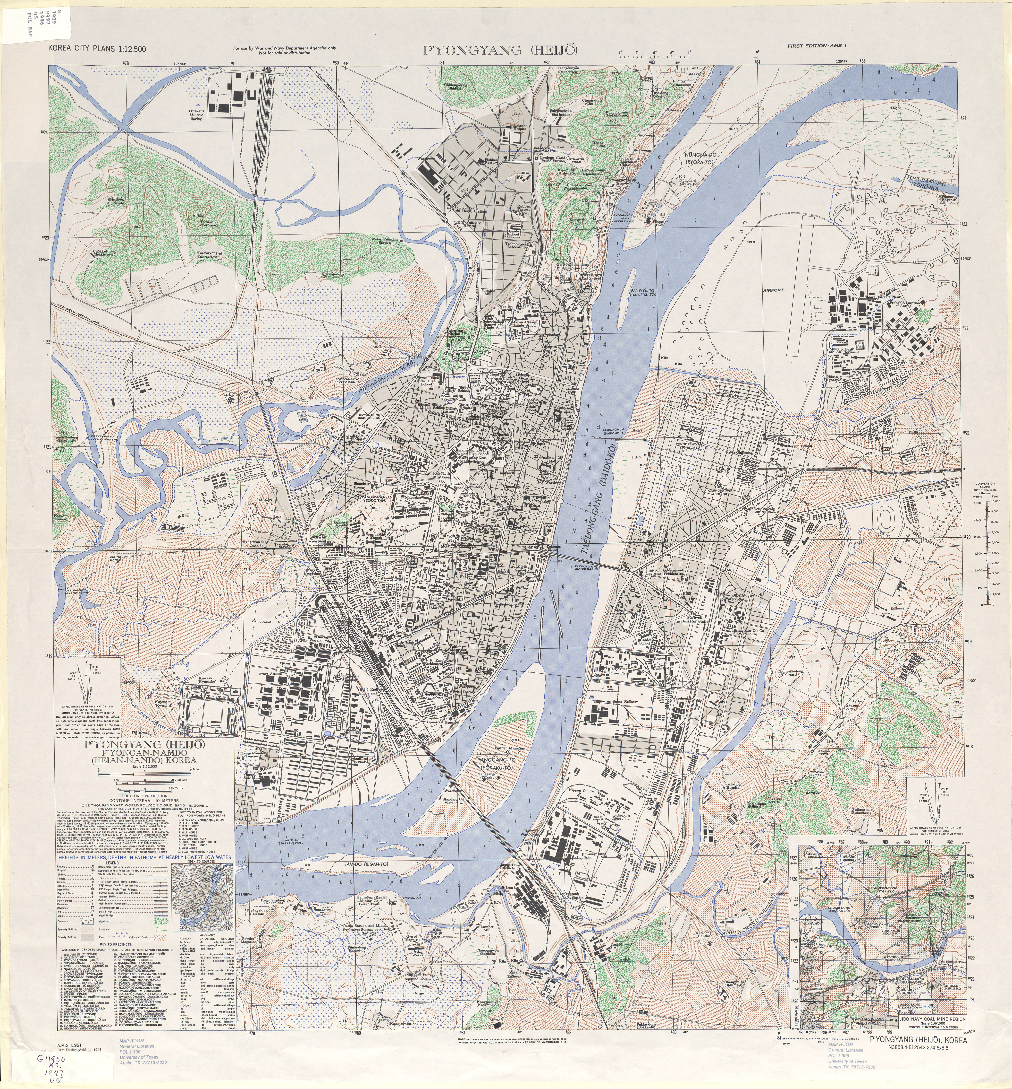
English: 1946 Map of Pyongyang (Heijo), North Korea by the Army Map Service, U.S. Army |
| 日期 | |
| 來源 | http://www.lib.utexas.edu/maps/ams/korea_city_plans/txu-oclc-6565231.jpg |
| 作者 |
Army Map Service, U.S. Army, Washington D.C. |
| 其他版本 |

| 這是一張修飾過的圖片,即本圖片是用軟體修改過後的版本,修改的方式或內容有:Ausschnitt。原版圖片來源:1946 Map of Pyongyang, Army Map Service, US Army.jpg。修改者:Nicor。
|
授權條款
|
|
 |
原始上傳日誌
This image is a derivative work of the following images:
- File:1946 Map of Pyongyang, Army Map Service, US Army.jpg licensed with PD-USGov-Military-Army
- 2010-02-11T07:49:55Z AniRaptor2001 4168x4481 (8116435 Bytes) {{Information |Description={{en|1=1946 Map of Pyongyang (Heijo), North Korea by the Army Map Service, U.S. Army}} |Source=http://www.lib.utexas.edu/maps/ams/korea_city_plans/txu-oclc-6565231.jpg |Author=Army Map Service, U.S.
檔案歷史
點選日期/時間以檢視該時間的檔案版本。
| 日期/時間 | 縮圖 | 尺寸 | 用戶 | 備註 | |
|---|---|---|---|---|---|
| 目前 | 2011年8月25日 (四) 12:50 | | 1,072 × 848(1.95 MB) | Nicor | {{Information |Description={{en|1=1946 Map of Pyongyang (Heijo), North Korea by the Army Map Service, U.S. Army}} |Source=*File:Pyongyangarmymapservice1946.png |Date=2011-08-25 12:49 (UTC) |Author=*File:Pyongyangarmymapservice1946.png: Army Ma |
檔案用途
下列頁面有用到此檔案:
全域檔案使用狀況
以下其他 wiki 使用了這個檔案:
- cs.wikipedia.org 的使用狀況
- de.wikipedia.org 的使用狀況
- en.wikipedia.org 的使用狀況
- fa.wikipedia.org 的使用狀況
- ko.wikipedia.org 的使用狀況
- tl.wikipedia.org 的使用狀況
- www.wikidata.org 的使用狀況