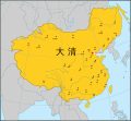
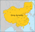
File:Map of Qing dynasty 18c Chinese.svg
外觀

此 SVG 檔案的 PNG 預覽的大小:649 × 600 像素。 其他解析度:260 × 240 像素 | 519 × 480 像素 | 831 × 768 像素 | 1,108 × 1,024 像素 | 2,215 × 2,048 像素 | 834 × 771 像素。
原始檔案 (SVG 檔案,表面大小:834 × 771 像素,檔案大小:189 KB)
檔案歷史
點選日期/時間以檢視該時間的檔案版本。
| 日期/時間 | 縮圖 | 尺寸 | 用戶 | 備註 | |
|---|---|---|---|---|---|
| 目前 | 2022年5月27日 (五) 17:18 |  | 834 × 771(189 KB) | En rouge | The map width has been enlarged to include the full display of Sakhalin. As a result, the Japanese coastlines and the Philippine coastlines were extended, as requested in [Commons:Graphic_Lab/Map_workshop] by Benzenekim on 2022-03-12 07:17 |
| 2020年12月26日 (六) 15:11 |  | 512 × 498(178 KB) | Nv7801 | Fix Anqing | |
| 2020年12月26日 (六) 08:59 |  | 512 × 498(178 KB) | Nv7801 | Outer Northeast Cities | |
| 2020年12月26日 (六) 08:47 |  | 512 × 498(165 KB) | Nv7801 | Add major cities name | |
| 2019年6月2日 (日) 08:28 |  | 512 × 498(37 KB) | DokiDonkey | Add Southern Tibet and border fix about Yunnan and Guangxi. | |
| 2016年8月13日 (六) 05:18 |  | 790 × 768(57 KB) | Nv7801 | User created page with UploadWizard |
檔案用途
全域檔案使用狀況
以下其他 wiki 使用了這個檔案:
- pt.wikipedia.org 的使用狀況
- zh.wikinews.org 的使用狀況


