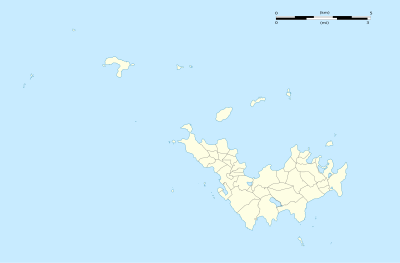
模板:Location map Saint Barthélemy
| 名稱 | 聖巴泰勒米 | |||
|---|---|---|---|---|
| 邊界坐標 | ||||
| 17.9875 | ||||
| -62.9625 | ←↕→ | -62.7625 | ||
| 17.8625 | ||||
| 地圖中心 | 17°55′30″N 62°51′45″W / 17.925°N 62.8625°W | |||
| 圖像 | Saint-Barthélemy collectivity location map with quartiers.svg | |||

| ||||
| 附加圖像㈠ | Saint-Barthélemy collectivity relief location map.jpg | |||

| ||||
| 附加圖像㈡ | Saint-Barthélemy collectivity location map.svg | |||

| ||||
