卡里布-塔基國家森林
外觀
| Caribou-Targhee National Forest 卡里布-塔基國家森林 | |
|---|---|
IUCN分類VI(資源管理保護區) | |
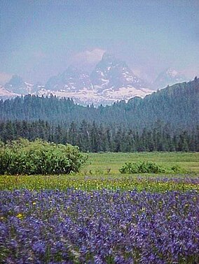
 Camas flowers and the west vista of the Teton Range from Caribou-Targhee National Forest | |
| 位置 | 美國愛達荷州、懷俄明州、猶他州 |
| 最近城市 | 波卡特洛 |
| 座標 | 42°47′0″N 111°33′0″W / 42.78333°N 111.55000°W |
| 面積 | 2,630,716英畝(10,646.13平方公里)[1] |
| 建立 | 1903年 |
| 管理機構 | 美國國家森林局 |
| 網站 | Caribou-Targhee National Forest |
卡里布-塔基國家森林(英語:Caribou-Targhee National Forest)是美國的一處國家森林,1903年建立,位處懷俄明州、愛達荷州(猶他州也有一小部分),佔地面積超過2.63 × 10⁶英畝(10.6 × 10³平方公里),最近的城市為波卡特洛。
參考資料
[編輯]- ^ Land Areas of the National Forest System (PDF). U.S. Forest Service. January 2012 [June 30, 2012]. (原始內容存檔 (PDF)於2012-11-01).
外部連結
[編輯]維基共享資源上的相關多媒體資源:卡里布-塔基國家森林
- "Caribou National Forest-Montpelier Ranger District-Montpelier Watershed Analysis"[永久失效連結]
- "Lumber, Stone & Concrete", Administrative Facilities of the Caribou-Targhee National Forests, 1891-1955 (頁面存檔備份,存於互聯網檔案館)
- Caribou-Targhee National Forest. U.S. Forest Service. [2006-07-08]. (原始內容存檔於2020-12-15).
| 這是一篇與美國地理相關的小作品。您可以透過編輯或修訂擴充其內容。 |

