凯蒙山
外观
| 凯蒙山 | |
|---|---|
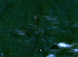
 凯蒙山及其周围地区的卫星图像 | |
| 最高点 | |
| 海拔 | 1847米 |
| 坐标 | 1°51′37″N 116°10′35″E / 1.86028°N 116.17639°E |
| 地理 | |
| 位置 | 婆罗洲东加里曼丹 |
凯蒙山(印尼语:Gunung Kemul)位于东加里曼丹。其为暗色猪笼草(Nepenthes fusca)和柔毛猪笼草(Nepenthes mollis)的模式产地。[1]
参考文献
[编辑]- ^ Phillipps, A. & A. Lamb. Pitcher-Plants of Borneo. Kota Kinabalu: Natural History Publications (Borneo). 1996.
