
File:Enstone-airfield-the-grand-tour-gravel-test-track-20171223.svg

此SVG文件的PNG预览的大小:790 × 273像素。 其他分辨率:320 × 111像素 | 640 × 221像素 | 1,024 × 354像素 | 1,280 × 442像素 | 2,560 × 885像素。
原始文件 (SVG文件,尺寸为790 × 273像素,文件大小:1.86 MB)
摘要
| 描述 |
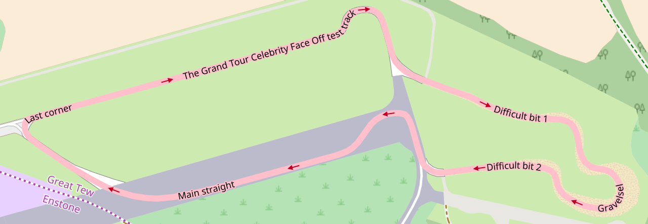
English: w:The Grand Tour (TV series) test track at the former w:RAF Enstone, home of w:Enstone Airfield. The course is constructed of sections of former test track, a redesign of an existing gravel course, and a section on the former main runway—joined together with new asphalt stub sections. Obtained with [1]. |
| 日期 | |
| 来源 | w:OpenStreetMap |
| 作者 | OpenStreetMap Contributors. |
| 相机位置 | | 在以下服务上查看本图像和附近其他图像: OpenStreetMap |
|---|
许可协议
| This work contains information from OpenStreetMap, which is made available under the Open Database License (ODbL).
The ODbL does not require any particular license for maps produced from ODbL data. Prior to 1 August 2020, map tiles produced by the OpenStreetMap Foundation were licensed under the CC-BY-SA-2.0 license. Maps produced by other people may be subject to other licences. |
文件历史
点击某个日期/时间查看对应时刻的文件。
| 日期/时间 | 缩略图 | 大小 | 用户 | 备注 | |
|---|---|---|---|---|---|
| 当前 | 2017年12月23日 (六) 12:25 | 790 × 273(1.86 MB) | Sladen | User created page with UploadWizard |
文件用途
以下页面使用本文件:
全域文件用途
以下其他wiki使用此文件:
- cs.wikipedia.org上的用途
- de.wikipedia.org上的用途
- en.wikipedia.org上的用途
- fa.wikipedia.org上的用途
- ru.wikipedia.org上的用途