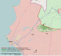
File:Latakia Offensive Map.svg
外观

此SVG文件的PNG预览的大小:654 × 600像素。 其他分辨率:262 × 240像素 | 523 × 480像素 | 837 × 768像素 | 1,116 × 1,024像素 | 2,232 × 2,048像素 | 1,477 × 1,355像素。
原始文件 (SVG文件,尺寸为1,477 × 1,355像素,文件大小:2.37 MB)
文件历史
点击某个日期/时间查看对应时刻的文件。
| 日期/时间 | 缩略图 | 大小 | 用户 | 备注 | |
|---|---|---|---|---|---|
| 当前 | 2013年10月13日 (日) 13:09 |  | 1,477 × 1,355(2.37 MB) | MrPenguin20 | All villages recaptured by SAA. |
| 2013年8月24日 (六) 03:59 |  | 1,477 × 1,355(2.37 MB) | MrPenguin20 | Added villages and names. Added Nabi Younes to map. Reworked arrows showing opposition advance. Demarked villages remaining under opposition control. | |
| 2013年8月22日 (四) 11:08 |  | 1,477 × 1,355(2.36 MB) | MrPenguin20 | Better delineated frontline around Jisr al-Shughur | |
| 2013年8月21日 (三) 12:39 |  | 1,477 × 1,355(2.36 MB) | MrPenguin20 | Small fix to overlapping colours at frontline. Named Jisr al-Shughur on map (apparently it's currently under Syrian Government control) | |
| 2013年8月21日 (三) 01:02 |  | 1,477 × 1,355(2.38 MB) | MrPenguin20 | Moved line denoting pre-battle (and 19 August) frontline | |
| 2013年8月21日 (三) 00:59 |  | 1,477 × 1,355(2.38 MB) | MrPenguin20 | User created page with UploadWizard |
文件用途
以下页面使用本文件:
全域文件用途
以下其他wiki使用此文件:
- ar.wikipedia.org上的用途
- en.wikipedia.org上的用途
- es.wikipedia.org上的用途
- fr.wikipedia.org上的用途
- it.wikipedia.org上的用途
- pl.wikipedia.org上的用途
- www.wikidata.org上的用途


