
File:MapaMacau1912.jpg
本预览的尺寸:416 × 599像素。 其他分辨率:167 × 240像素 | 631 × 908像素。
原始文件 (631 × 908像素,文件大小:81 KB,MIME类型:image/jpeg)
摘要
| 描述 |
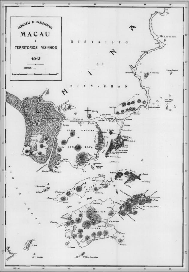
English: This is a map of Macau and is surrounded territories in 1912. In that time, the Portuguese Colony of Macau is formed by the Peninsula de Macau, Taipa and Coloane islands. Macau also have a great influence on the islands of Lapa, D. João and Montanha, located on the west of the Portuguese Colony of Macau. See here for original color version. |
| 日期 | |
| 来源 | |
| 作者 |
许可协议
|
|
 | |
| 注解 | 该图片含有注解:在维基媒体共享资源上查看注解 |
文件历史
点击某个日期/时间查看对应时刻的文件。
| 日期/时间 | 缩略图 | 大小 | 用户 | 备注 | |
|---|---|---|---|---|---|
| 当前 | 2007年2月14日 (三) 09:34 | | 631 × 908(81 KB) | AdriAg | This is a map of Macau and is surrounded territories in 1912. In that time, the Portuguese Colony of Macau is formed by the [http://pt.wikipedia.org/wiki/Pen%C3%ADnsula_de_Macau Peninsula de Macau], [http://pt.wikipedia.org/wiki/Taipa Taipa] and [http://p |
文件用途
以下5个页面使用本文件:
全域文件用途
以下其他wiki使用此文件:
- en.wikipedia.org上的用途
- es.wikipedia.org上的用途
- fa.wikipedia.org上的用途
- fr.wikipedia.org上的用途
- it.wikipedia.org上的用途
- ja.wikipedia.org上的用途
- mwl.wikipedia.org上的用途
- nl.wikipedia.org上的用途
- no.wikipedia.org上的用途
- pt.wikipedia.org上的用途
- ru.wikipedia.org上的用途
- ur.wikipedia.org上的用途