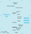
File:Northern Mariana Islands-CIA WFB Map.png
外观
Northern_Mariana_Islands-CIA_WFB_Map.png (325 × 349像素,文件大小:6 KB,MIME类型:image/png)
文件历史
点击某个日期/时间查看对应时刻的文件。
| 日期/时间 | 缩略图 | 大小 | 用户 | 备注 | |
|---|---|---|---|---|---|
| 当前 | 2022年2月13日 (日) 05:14 |  | 325 × 349(6 KB) | Lojwe | Cropped 1 % horizontally, 1 % vertically using CropTool with precise mode. |
| 2006年1月30日 (一) 09:10 |  | 328 × 352(7 KB) | Hoshie | Updated map of the CNMI from the CIA World Factbook, 10 Jan 06 rev: http://www.cia.gov/cia/publications/factbook/maps/cq-map.gif | |
| 2005年3月27日 (日) 09:17 |  | 329 × 355(5 KB) | Wolfman~commonswiki | {{CIA-map}} |
文件用途
全域文件用途
以下其他wiki使用此文件:
- bn.wikipedia.org上的用途
- ca.wikipedia.org上的用途
- ch.wikipedia.org上的用途
- de.wikipedia.org上的用途
- en.wikipedia.org上的用途
- Non-voting members of the United States House of Representatives
- National Register of Historic Places listings in the Northern Mariana Islands
- Maug Islands
- Golden white-eye
- File talk:Northern Mariana Islands-CIA WFB Map.png
- Outline of the Northern Mariana Islands
- Index of Northern Mariana Islands–related articles
- Northern Mariana Islands's at-large congressional district
- List of Northern Mariana Islands territorial symbols
- List of lakes of the Northern Mariana Islands
- en.wikisource.org上的用途
- es.wikipedia.org上的用途
- et.wikipedia.org上的用途
- fi.wikipedia.org上的用途
- fo.wikipedia.org上的用途
- fr.wikipedia.org上的用途
- fy.wikipedia.org上的用途
- gl.wikipedia.org上的用途
- hu.wikipedia.org上的用途
- id.wikipedia.org上的用途
- it.wikipedia.org上的用途
- ja.wikipedia.org上的用途
- ka.wikipedia.org上的用途
- nl.wikipedia.org上的用途
查看此文件的更多全域用途。


