File:Sweden relief location map.jpg
外观

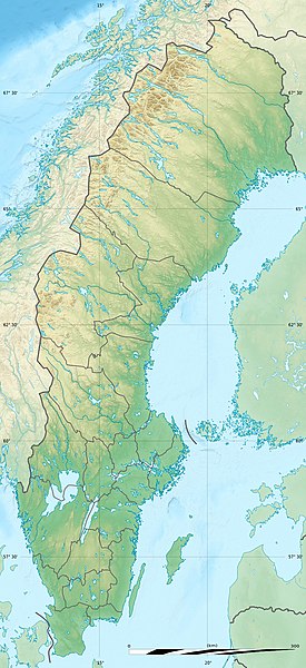
本预览的尺寸:275 × 600像素。 其他分辨率:110 × 240像素 | 220 × 480像素 | 842 × 1,837像素。
原始文件 (842 × 1,837像素,文件大小:541 KB,MIME类型:image/jpeg)
文件历史
点击某个日期/时间查看对应时刻的文件。
| 日期/时间 | 缩略图 | 大小 | 用户 | 备注 | |
|---|---|---|---|---|---|
| 当前 | 2017年9月30日 (六) 23:52 |  | 842 × 1,837(541 KB) | Sting | Reverted to version as of 17:54, 5 August 2011 (UTC) - Negative: that would be the scale at the extreme top of the map which would introduce a reading error for the lower latitudes |
| 2017年9月30日 (六) 23:29 |  | 842 × 1,837(743 KB) | SlotaWoj | After adjusting the distance ruler. | |
| 2011年8月5日 (五) 17:54 |  | 842 × 1,837(541 KB) | Sting | == {{int:filedesc}} == {{Location|62|18|00|N|17|30|00|E|scale:7000000}} {{Information |Description= {{de|Relief Positionskarte von Schweden}} {{en|Blank relief location map of Sweden}} {{fr|Carte physique vierge de la [[:fr |
文件用途
以下11个页面使用本文件:
全域文件用途
以下其他wiki使用此文件:
- als.wikipedia.org上的用途
- ar.wikipedia.org上的用途
- arz.wikipedia.org上的用途
- ast.wikipedia.org上的用途
- az.wikipedia.org上的用途
- Şablon:Yer xəritəsi İsveç
- Eland
- Venern gölü
- Vettern gölü
- Aland dənizi
- Botnik dənizi
- Cənubi Kvarken boğazı
- Şimali Kvarken boğazı
- Foresund boğazı
- Kalmarsund boğazı
- Skone yarımadası
- Kataya adası
- Blidyo adası
- İnqaryo adası
- Qotland adası
- Vermdyo adası
- Foqlaryo adası
- Kollandsyo adası
- Vendotberget
- Qrenbi krateri
- Kyrksjön
- Uraniborq rəsədxanası
- Lilqrund külək ferması
- be.wikipedia.org上的用途
查看此文件的更多全域用途。


