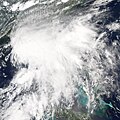
File:Alberto 2006-06-12 1830Z.jpg
外观

本预览的尺寸:475 × 600像素。 其他分辨率:190 × 240像素 | 380 × 480像素 | 608 × 768像素 | 811 × 1,024像素 | 1,622 × 2,048像素 | 6,100 × 7,700像素。
原始文件 (6,100 × 7,700像素,文件大小:20.93 MB,MIME类型:image/jpeg)
文件历史
点击某个日期/时间查看对应时刻的文件。
| 日期/时间 | 缩略图 | 大小 | 用户 | 备注 | |
|---|---|---|---|---|---|
| 当前 | 2019年9月6日 (五) 03:51 |  | 6,100 × 7,700(20.93 MB) | Supportstorm | Higher quality |
| 2018年12月6日 (四) 23:05 |  | 5,600 × 7,400(6.98 MB) | FleurDeOdile | worldview | |
| 2015年12月27日 (日) 16:15 |  | 5,503 × 5,503(3.18 MB) | Nino Marakot | Reverted to version as of 18:33, 13 June 2006 (UTC) | |
| 2013年11月13日 (三) 04:07 |  | 5,503 × 5,503(3.59 MB) | TheAustinMan | Reverted (Earth's image exists not one but two other times...) | |
| 2013年6月9日 (日) 09:27 |  | 7,500 × 7,500(5.25 MB) | Earth100 | Best Image | |
| 2010年6月30日 (三) 19:21 |  | 5,503 × 5,503(3.59 MB) | Supportstorm | Contrast Correction/ Sharpened | |
| 2006年6月13日 (二) 18:33 |  | 5,503 × 5,503(3.18 MB) | Good kitty | ||
| 2006年6月13日 (二) 18:28 |  | 5,503 × 5,503(3.57 MB) | Good kitty | ||
| 2006年6月12日 (一) 15:44 |  | 4,500 × 4,500(3.27 MB) | Good kitty | Tropical Storm Alberto formed as an unnamed tropical depression early in the morning on June 10, 2006, in the Yucatan Channel. This narrow gap of ocean lies between the western end of Cuba and the Yucatan Peninsula at the mouth of the Gulf of Mexico. Albe |
文件用途
以下18个页面使用本文件:
- 2006年大西洋颶風季
- 2006年大西洋飓风季时间轴
- 2006年热带风暴阿尔贝托
- Talk:2006年热带风暴阿尔贝托
- Wikipedia:优良条目/2006年热带风暴阿尔贝托
- Wikipedia:优良条目/2014年8月
- Wikipedia:优良条目/2014年8月29日
- Wikipedia:典范条目/2006年热带风暴阿尔贝托
- Wikipedia:典范条目/2014年6月
- Wikipedia:典范条目/2014年6月26日
- Wikipedia:典范条目/2016年5月
- Wikipedia:典范条目/2016年5月25日
- Wikipedia:典范条目/2018年8月
- Wikipedia:典范条目/2018年8月28日
- Wikipedia:典范条目/2022年5月
- Wikipedia:典范条目/2022年5月4日
- Portal:美國/特色條目
- Portal:美國/特色條目/149
全域文件用途
以下其他wiki使用此文件:
- de.wikipedia.org上的用途
- en.wikipedia.org上的用途
- User talk:Super-Magician
- 2006 Atlantic hurricane season
- User talk:CrazyC83
- User talk:AySz88
- User talk:BazookaJoe
- User:Merovingian/archive-13
- Timeline of the 2006 Atlantic hurricane season
- Tropical Storm Alberto (2006)
- User talk:NSLE/Archive 12
- User talk:WeatherVane
- User talk:Coredesat/Newsletters
- Wikipedia:WikiProject Tropical cyclones/Newsletter/Archive 2
- Wikipedia talk:WikiProject Tropical cyclones/Newsletter/Archive 2
- User talk:Miss Madeline/Archive Early 2006
- User talk:Titoxd/Archive16
- User talk:Icelandic Hurricane/July Archive
- User:Bob rulz/Hurricane Herald
- User talk:A7x/Newsletters
- User talk:Cyclone1/Archive1
- User talk:Hurricanehink/Archive 6
- User talk:Pobbie Rarr/Tropical cyclones WikiProject Newsletter archive
- User talk:Ajm81/Newsletters
- User talk:The Grid/Archive 1
- User talk:RaNdOm26/Archive 1
- User talk:Jamie C/Archive 1
- User talk:Typhoonchaser/Archive 1
- User talk:Sarsaparilla39/Archive 1
- Wikipedia:WikiProject Tropical cyclones/Newsletter/Archive
- Wikipedia:Main Page history/2011 June 17
- User talk:Hurricanehink/Archive 22
- es.wikipedia.org上的用途
- eu.wikipedia.org上的用途
- it.wikipedia.org上的用途
- ja.wikipedia.org上的用途
- ko.wikipedia.org上的用途
- pt.wikipedia.org上的用途
- simple.wikipedia.org上的用途
- sv.wikipedia.org上的用途
- www.wikidata.org上的用途


