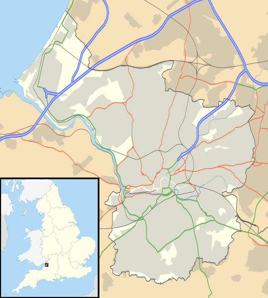
File:Bristol UK location map.svg
外观

此SVG文件的PNG预览的大小:539 × 600像素。 其他分辨率:216 × 240像素 | 431 × 480像素 | 690 × 768像素 | 920 × 1,024像素 | 1,841 × 2,048像素 | 1,138 × 1,266像素。
原始文件 (SVG文件,尺寸为1,138 × 1,266像素,文件大小:683 KB)
文件历史
点击某个日期/时间查看对应时刻的文件。
| 日期/时间 | 缩略图 | 大小 | 用户 | 备注 | |
|---|---|---|---|---|---|
| 当前 | 2010年9月26日 (日) 17:58 |  | 1,138 × 1,266(683 KB) | Nilfanion | {{Information |Description=Map of Bristol, UK with the following information shown: *Administrative borders *Coastline, lakes and rivers *Roads and railways *Urban areas Equirectangular map projection on WGS 84 datum, with N/S stretched 160 |
文件用途
全域文件用途
以下其他wiki使用此文件:
- ar.wikipedia.org上的用途
- bn.wikipedia.org上的用途
- ceb.wikipedia.org上的用途
- el.wikipedia.org上的用途
- en.wikipedia.org上的用途
- Clifton Suspension Bridge
- St Mary Redcliffe
- Bristol Cathedral
- Clifton Cathedral
- Avonmouth
- Catbrain
- Bristol Old Vic Theatre School
- St Werburghs
- Clifton Down
- Durdham Down
- The Downs, Bristol
- Avon Gorge
- We the Curious
- Bristol Museum & Art Gallery
- Arnolfini, Bristol
- Snuff Mills
- Bristol Industrial Museum
- Llandoger Trow
- Withywood
- St Pauls, Bristol
- Stapleton, Bristol
- Brislington
- Knowle West
- Totterdown
- Blaise Castle Estate
- Blaise Hamlet
- Fishponds
- Canon's Marsh
- St Matthias, Bristol
- Glenside, Bristol
- Shirehampton
- Tobacco Factory
- Spike Island, Bristol
- Avonmouth Bridge
- Eastville, Bristol
- Eastville Stadium
- Montpelier, Bristol
- The Chessels
- British Empire and Commonwealth Museum
- Lawrence Weston, Bristol
- St Brendan's Sixth Form College
- Purdown BT Tower
- Westbury College Gatehouse
查看此文件的更多全域用途。

