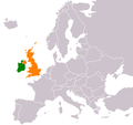
File:Ireland United Kingdom Locator.png
外观

本预览的尺寸:656 × 600像素。 其他分辨率:263 × 240像素 | 525 × 480像素 | 840 × 768像素 | 1,270 × 1,161像素。
原始文件 (1,270 × 1,161像素,文件大小:95 KB,MIME类型:image/png)
文件历史
点击某个日期/时间查看对应时刻的文件。
| 日期/时间 | 缩略图 | 大小 | 用户 | 备注 | |
|---|---|---|---|---|---|
| 当前 | 2023年5月28日 (日) 22:57 |  | 1,270 × 1,161(95 KB) | Aquintero82 | Updated map |
| 2013年5月25日 (六) 17:28 |  | 450 × 422(15 KB) | Dmcq | Reverted to version as of 22:52, 6 May 2013: Sorry I see it is some stupid MOS standard | |
| 2013年5月25日 (六) 17:23 |  | 450 × 422(11 KB) | Dmcq | Reverted to version as of 03:02, 16 January 2012: use more standard colours | |
| 2013年5月25日 (六) 17:22 |  | 450 × 422(11 KB) | Dmcq | Reverted to version as of 03:02, 16 January 2012 | |
| 2013年5月6日 (一) 22:52 |  | 450 × 422(15 KB) | Chipmunkdavis | Reverted to version as of 03:02, 16 January 2012 Circling all the microstates puts an emphasis on them, which is not the point of this map | |
| 2013年5月6日 (一) 22:04 |  | 450 × 422(20 KB) | Britannic124 | More standard image. | |
| 2012年1月16日 (一) 03:02 |  | 450 × 422(15 KB) | OgreBot | (BOT): Reverting to most recent version before archival | |
| 2012年1月16日 (一) 03:02 |  | 450 × 422(11 KB) | OgreBot | (BOT): Uploading old version of file from en.wikipedia; originally uploaded on 2010-08-29 10:50:15 by Mabuska | |
| 2012年1月15日 (日) 04:53 |  | 450 × 422(15 KB) | File Upload Bot (Magnus Manske) | {{BotMoveToCommons|en.wikipedia|year={{subst:CURRENTYEAR}}|month={{subst:CURRENTMONTHNAME}}|day={{subst:CURRENTDAY}}}} {{Information |Description={{en|'''Description:''' Map of the world indicating the United Kingdom and Republic of Ireland. For use in [ |
文件用途
以下页面使用本文件:
全域文件用途
以下其他wiki使用此文件:
- ar.wikipedia.org上的用途
- de.wikipedia.org上的用途
- en.wikipedia.org上的用途
- es.wikipedia.org上的用途
- fa.wikipedia.org上的用途
- fr.wikipedia.org上的用途
- he.wikipedia.org上的用途
- ja.wikipedia.org上的用途
- pt.wikipedia.org上的用途
- ru.wikipedia.org上的用途
- uk.wikipedia.org上的用途
- www.wikidata.org上的用途


