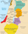
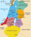
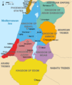
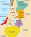
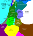
File:Kingdoms around Israel 830 map.svg
外观

此SVG文件的PNG预览的大小:502 × 599像素。 其他分辨率:201 × 240像素 | 402 × 480像素 | 644 × 768像素 | 858 × 1,024像素 | 1,717 × 2,048像素 | 720 × 859像素。
原始文件 (SVG文件,尺寸为720 × 859像素,文件大小:122 KB)
文件历史
点击某个日期/时间查看对应时刻的文件。
| 日期/时间 | 缩略图 | 大小 | 用户 | 备注 | |
|---|---|---|---|---|---|
| 当前 | 2022年10月29日 (六) 15:32 |  | 720 × 859(122 KB) | Muchado | Fixing font problems (hopefully) |
| 2022年10月29日 (六) 15:11 | 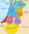 | 720 × 859(283 KB) | Muchado | Added "Philistine City States" which was unintentionally missed off... | |
| 2022年10月29日 (六) 15:06 |  | 720 × 859(239 KB) | Muchado | Coloured states, removed anachronistic Petra, added Bozrah, removed Urmomium (Your mom...!), edited Arabu to Arubu, edited to Philistine City States | |
| 2017年2月10日 (五) 15:51 |  | 720 × 859(167 KB) | Malus Catulus | Removed 'Sizu' - a weird artifact from the Norse original | |
| 2010年7月13日 (二) 12:58 |  | 720 × 859(165 KB) | Malus Catulus | livened up the colors, converted med sea text to path | |
| 2010年7月13日 (二) 11:26 |  | 720 × 859(139 KB) | Malus Catulus | {{Information |Description={{en|1=Map showing the ancient levant borders and ancient cities such as Urmomium and Jerash. The Kingdoms around Israel and Judah are colored. The map also shows the region in the 9th century BCE. Notice the coastal lan |
文件用途
全域文件用途
以下其他wiki使用此文件:
- af.wikipedia.org上的用途
- arc.wikipedia.org上的用途
- ar.wikipedia.org上的用途
- arz.wikipedia.org上的用途
- azb.wikipedia.org上的用途
- bg.wikipedia.org上的用途
- bn.wikipedia.org上的用途
- br.wikipedia.org上的用途
- cs.wikipedia.org上的用途
- da.wikipedia.org上的用途
- en.wikipedia.org上的用途
- Ammon
- History of the ancient Levant
- Philistines
- Moab
- Philistia
- Talk:Phoenician language
- Aram-Damascus
- Edom
- Portal:Bible/Featured chapter/Psalms
- Portal:Bible/Featured chapter/Psalms 83
- User:Kazkaskazkasako/Books/History
- Transjordan (region)
- Ezekiel 25
- File talk:Kingdoms around Israel 830 map.svg
- User:Jacksonmcdonald3425/sandbox
- User:Falcaorib/Ancient Empires (4000-550 BC)
- en.wiktionary.org上的用途
- eo.wikipedia.org上的用途
- et.wikipedia.org上的用途
查看此文件的更多全域用途。


