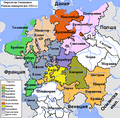
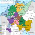
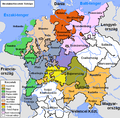
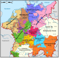
File:Map of the Imperial Circles (1512)-en.png
外观
Map_of_the_Imperial_Circles_(1512)-en.png (610 × 599像素,文件大小:321 KB,MIME类型:image/png)
文件历史
点击某个日期/时间查看对应时刻的文件。
| 日期/时间 | 缩略图 | 大小 | 用户 | 备注 | |
|---|---|---|---|---|---|
| 当前 | 2006年6月17日 (六) 01:39 | 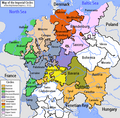 | 610 × 599(321 KB) | ~Pyb | en:User:Silverhelm is the author of this image file. Its contents are based in part on a map published in the "Historical Atlas" by Prof. William R Shepherd, pub. Henry Holt & Co. (New York, 1911). Category:Maps of the Holy Roman Empire |
文件用途
以下14个页面使用本文件:
全域文件用途
以下其他wiki使用此文件:
- azb.wikipedia.org上的用途
- az.wikipedia.org上的用途
- be.wikipedia.org上的用途
- bg.wikipedia.org上的用途
- История на Германия
- Бургундски имперски окръг
- Имперски окръг
- Баварски имперски окръг
- Австрийски имперски окръг
- Доленрейнски-Вестфалски имперски окръг
- Долносаксонски имперски окръг
- Шаблон:Имперски окръзи на Свещената Римска империя
- Франконски имперски окръг
- Саксонски имперски окръг
- Швабски имперски окръг
- Куррейнски имперски оркръг
- Горносаксонски имперски окръг
- cs.wikipedia.org上的用途
- cv.wikipedia.org上的用途
- de.wikipedia.org上的用途
- dsb.wikipedia.org上的用途
- el.wikipedia.org上的用途
- en.wikipedia.org上的用途
- History of Germany
- Holy Roman Empire
- Lower Saxony
- Imperial circle
- Talk:Wilhelmus
- History of Silesia
- 1632 series
- Austrian Circle
- Bavarian Circle
- Category:Circles of the Holy Roman Empire
- Burgundian Circle
- Franconian Circle
- Lower Saxon Circle
- Upper Saxon Circle
- User:Silverhelm/Maps
- Electoral Rhenish Circle
- Lower Rhenish–Westphalian Circle
- Swabian Circle
- Upper Rhenish Circle
- House of Schwarzenberg
- Wikipedia:WikiProject Former countries/Holy Roman Empire task force
- Template:Circles of the Holy Roman Empire
- User:Conservativegbd
- Coats of arms of the Holy Roman Empire
- Talk:Nicolaus Copernicus/Archive 5
- History of the Catholic Church in Germany
- User:InforManiac/Navbox04
查看此文件的更多全域用途。


