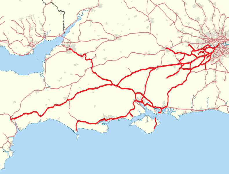
File:South West Trains route map 2010.svg
外观

此SVG文件的PNG预览的大小:790 × 599像素。 其他分辨率:316 × 240像素 | 633 × 480像素 | 1,012 × 768像素 | 1,280 × 971像素 | 2,560 × 1,942像素 | 999 × 758像素。
原始文件 (SVG文件,尺寸为999 × 758像素,文件大小:859 KB)
文件历史
点击某个日期/时间查看对应时刻的文件。
| 日期/时间 | 缩略图 | 大小 | 用户 | 备注 | |
|---|---|---|---|---|---|
| 当前 | 2014年2月2日 (日) 00:39 |  | 999 × 758(859 KB) | Nilfanion | Add Island Line |
| 2011年1月30日 (日) 22:14 |  | 999 × 758(859 KB) | Nilfanion | tweak colour | |
| 2011年1月29日 (六) 21:43 |  | 999 × 758(893 KB) | Nilfanion | {{Information |Description=Map showing railway routes operated by South West Trains in 2010. The background map shows the coast of England and Wales and major urban areas. Equirectangular map projection on WGS 84 datum, with N/S st |
文件用途
以下页面使用本文件:
全域文件用途
以下其他wiki使用此文件:
- en.wikipedia.org上的用途
- fr.wikipedia.org上的用途
- simple.wikipedia.org上的用途
- www.wikidata.org上的用途


