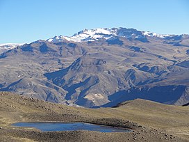
密斯米雪山
外觀
| Mismi | |
|---|---|
 | |
| 最高點 | |
| 海拔 | 5,597公尺(18,363英尺) |
| 座標 | 15°31′31″S 71°41′27″W / 15.52528°S 71.69083°W |
| 地理 | |
| 位置 | |
| 所屬山脈 | 安第斯山脈、奇拉山脈 |
| 地質 | |
| 山脈類型 | 複式火山 |

密斯米雪山(Nevado Mismi)位於秘魯阿雷基帕大區的的喀喀湖以西160公里,距離首都利馬700公里,這座層狀火山高5,597米(18,363英呎),其冰河在1996年、2001年和2007年被識別為亞馬遜河的源頭。[1][2][3]
參考文獻
[編輯]- ^ Source of the Amazon River Identificated (Jacek Palkiewicz). [2010-03-29]. (原始內容存檔於2007-03-12).
- ^ Explorers Pinpoint Source of the Amazon (National Geographic News). [2010-03-29]. (原始內容存檔於2017-11-01).
- ^ Amazon river 'longer than Nile' (BBC news) (頁面存檔備份,存於網際網路檔案館) (2007-06-16)
外部連結
[編輯]- Landscapes of the Soul - photos and story of a solo hike to the Source of the Amazon via the continental divide.
| 這是一篇與秘魯地理相關的小作品。您可以透過編輯或修訂擴充其內容。 |

