
File:7 subway extension and hudson yards.svg

此 SVG 檔案的 PNG 預覽的大小:700 × 400 像素。 其他解析度:320 × 183 像素 | 640 × 366 像素 | 1,024 × 585 像素 | 1,280 × 731 像素 | 2,560 × 1,463 像素。
原始檔案 (SVG 檔案,表面大小:700 × 400 像素,檔案大小:100 KB)
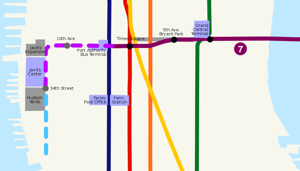
| 描述 | Route map of New York City Subway 7 Subway Extension, including planned station stops and hudson yards development. | ||
| 日期 | |||
| 來源 | self-made, based on Image:NYCS map 7.svg, Image:NYCS-bull-trans-7.svg and USGS topographical map | ||
| 作者 | ChrisRuvolo | ||
| 授權許可 (重用此檔案) |
|
檔案歷史
點選日期/時間以檢視該時間的檔案版本。
| 日期/時間 | 縮圖 | 尺寸 | 使用者 | 備註 | |
|---|---|---|---|---|---|
| 目前 | 2008年7月14日 (一) 18:32 | | 700 × 400(100 KB) | ChrisRuvolo | add 7 line bullet |
| 2008年7月7日 (一) 02:59 |  | 700 × 400(100 KB) | ChrisRuvolo | change coloration to match line map | |
| 2008年1月21日 (一) 19:43 |  | 700 × 400(99 KB) | ChrisRuvolo | fix stations | |
| 2008年1月21日 (一) 19:37 |  | 700 × 400(99 KB) | ChrisRuvolo | {{Information |Description=Route map of New York City Subway en:7 Subway Extension, including planned station stops and hudson yards development. |Source=self-made, based on Image:NYCS map 7.svg and USGS topographical map |Date=2007-01-21 |Auth |
檔案用途
下列2個頁面有用到此檔案:
全域檔案使用狀況
以下其他 wiki 使用了這個檔案:
- de.wikipedia.org 的使用狀況
- en.wikipedia.org 的使用狀況
- es.wikipedia.org 的使用狀況
- it.wikipedia.org 的使用狀況
- ja.wikipedia.org 的使用狀況
- www.wikidata.org 的使用狀況