
File:La2-demis-caribbean.png

預覽大小:800 × 504 像素。 其他解析度:320 × 201 像素 | 640 × 403 像素 | 891 × 561 像素。
原始檔案 (891 × 561 像素,檔案大小:149 KB,MIME 類型:image/png)
摘要
| 描述 |
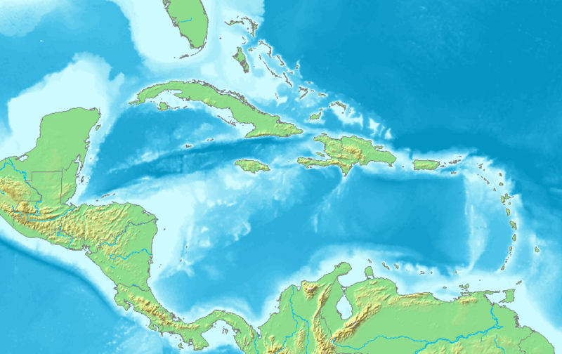
English: Map of the Caribbean and Central America.
Bounding box West -93°, South 7°, East -58°, North 28°. Center at 17°30′00″N 75°30′00″W / 17.50000°N 75.50000°W. |
| 日期 | |
| 來源 | Demis map server |
| 作者 | Demis map server |
| 其他版本 | Derivative works of this file: La2-demis-caribbean gs.png |
This image is in the public domain because it came from the site https://www.demis.nl/products/web-map-server/examples/ and was released by the copyright holder. Permission is granted to copy, distribute and/or modify this map since it is based on free of copyright images from: www.demis.nl. See also approval email on de.wp and its clarification.
|
| This work has been released into the public domain by its copyright holder, www.demis.nl. This applies worldwide. 這可能在某些國家不合法,如果是的話: www.demis.nl授予任何人有權利使用此作品於任何用途,除受法律約束外,不受任何限制。
|
檔案歷史
點選日期/時間以檢視該時間的檔案版本。
| 日期/時間 | 縮圖 | 尺寸 | 使用者 | 備註 | |
|---|---|---|---|---|---|
| 目前 | 2018年11月23日 (五) 05:10 | | 891 × 561(149 KB) | Opencooper | rm watermark |
| 2005年9月2日 (五) 13:20 |  | 891 × 561(170 KB) | LA2 | Map of the Carribean and Central America. Bounding box West -93°, South 7°, East -58°, North 28°. {{demis-pd}} category:maps of America |
檔案用途
沒有使用此檔案的頁面。
全域檔案使用狀況
以下其他 wiki 使用了這個檔案:
- am.wikipedia.org 的使用狀況
- ar.wikipedia.org 的使用狀況
- كريستوفر كولومبوس
- تصنيف:أمريكا الشمالية
- كوبا
- بليز
- أمريكا الشمالية
- سورينام
- غيانا
- جامايكا
- غرينادا
- تصنيف:جامايكا
- مونتسرات
- سانت فينسنت والغرينادين
- ترينيداد وتوباغو
- أروبا
- مارتينيك
- تصنيف:ترينيداد وتوباغو
- دولار بربادوسي
- باربادوس
- دولار بهامي
- ناساو
- نشيد جزر البهاما الوطني
- اللغة الهولندية
- .an
- .aw
- البحر الكاريبي
- الكاريبي
- جزر الأنتيل
- جزر الأنتيل الكبرى
- جزر الأنتيل الصغرى
- هسبنيولا
- بورتوريكو
- ترينيداد
- أنتيغوا وباربودا
- .vi
- جزر الأنتيل الهولندية
- جزر العذراء
- جمهورية الدومينيكان
- هايتي
- غوادلوب
- جزر العذراء البريطانية
- جزر العذراء الأمريكية
- دومينيكا
- تصنيف:جمهورية الدومينيكان
- تصنيف:الكاريبي
- سانت لوسيا
- علم أروبا
- سانت كيتس ونيفيس
- بيزو كوبي
- إيان فلمنغ
檢視此檔案的更多全域使用狀況。