
File:LudaLandLease-Territory.png
預覽大小:688 × 599 像素。 其他解析度:276 × 240 像素 | 551 × 480 像素 | 882 × 768 像素 | 1,086 × 946 像素。
原始檔案 (1,086 × 946 像素,檔案大小:1.37 MB,MIME 類型:image/png)
摘要
| 描述 |
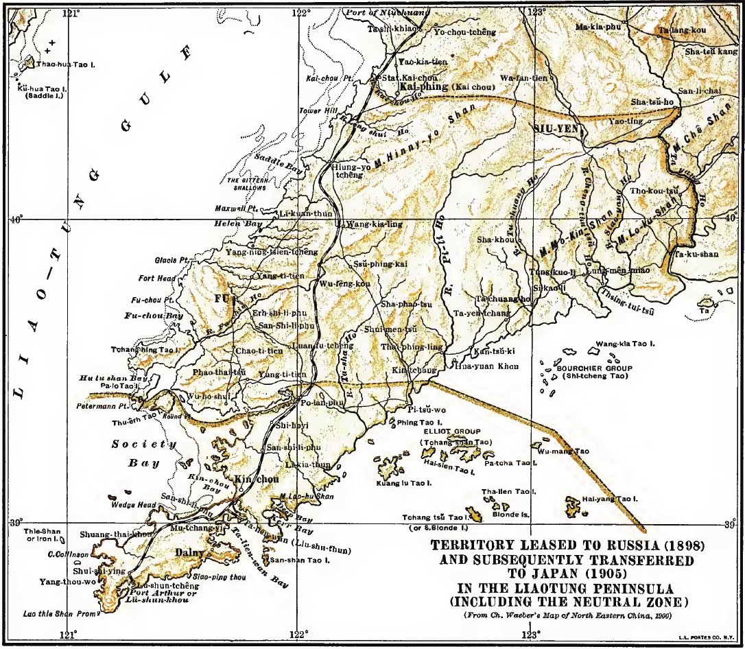
Deutsch: Karte des von Russland 1898 "gepachteten" und 1905 an Japan transferierten Gebietes der Liaodong Halbinsel sowie der neutralen Zone English: Territory Leased to Russia (1898) and subsequently transferred to Japan (1905) in the Liaotung Peninsula (including the neutral zone) |
| 日期 | |
| 來源 | used by John V.A. MacMurray in his book "Treaties and Agreements with and concerning China"; as scan archived unter https://archive.org/details/cu31924017545231 |
| 作者 | Original map from "Ch. Waeber's Map of North Eastern China (1900)" |
授權條款
|
本作品在其來源國以及其他著作權期限是作者逝世後70年或以下的國家與地區屬於公有領域。 | |
| 此作品無已知的著作權限制,亦不受所有相關和鄰接的權利限制。 | |
檔案歷史
點選日期/時間以檢視該時間的檔案版本。
| 日期/時間 | 縮圖 | 尺寸 | 使用者 | 備註 | |
|---|---|---|---|---|---|
| 目前 | 2011年5月30日 (一) 21:00 | | 1,086 × 946(1.37 MB) | Cccefalon |
檔案用途
下列3個頁面有用到此檔案:
全域檔案使用狀況
以下其他 wiki 使用了這個檔案:
- az.wikipedia.org 的使用狀況
- de.wikipedia.org 的使用狀況
- es.wikipedia.org 的使用狀況
- hy.wikipedia.org 的使用狀況
- ja.wikipedia.org 的使用狀況
- nl.wikipedia.org 的使用狀況
- no.wikipedia.org 的使用狀況
- ru.wikipedia.org 的使用狀況
- www.wikidata.org 的使用狀況