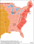
File:Map of territorial growth 1775.jpg
外观

本预览的尺寸:456 × 600像素。 其他分辨率:182 × 240像素 | 570 × 750像素。
原始文件 (570 × 750像素,文件大小:172 KB,MIME类型:image/jpeg)
文件历史
点击某个日期/时间查看对应时刻的文件。
| 日期/时间 | 缩略图 | 大小 | 用户 | 备注 | |
|---|---|---|---|---|---|
| 当前 | 2013年3月30日 (六) 03:07 |  | 570 × 750(172 KB) | Ras67 | cropped |
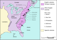
| 2006年12月3日 (日) 04:44 |  | 620 × 800(122 KB) | Dedee73 | The first 13 american colonies | |
| 2005年6月6日 (一) 21:13 |  | 620 × 800(122 KB) | Kooma | Map of territorial growth, 1775. From en.wiki. {{PD-USGov-Atlas}} Category:American Revolution |
文件用途
以下页面使用本文件:
全域文件用途
以下其他wiki使用此文件:
- ar.wikipedia.org上的用途
- az.wikipedia.org上的用途
- bg.wikipedia.org上的用途
- bn.wikipedia.org上的用途
- ca.wikipedia.org上的用途
- da.wikipedia.org上的用途
- el.wikipedia.org上的用途
- en.wikipedia.org上的用途
- American cuisine
- Empire
- British North America
- History of the United States (1776–1789)
- Timeline of the American Revolution
- Public Land Survey System
- History of Pennsylvania
- Constitutional history of Canada
- Cultural assimilation of Native Americans
- User:Notuncurious/Working/tmp3
- User:Notuncurious/Working/tmp6
- Aboriginal title in the United States
- Aboriginal title statutes in the Thirteen Colonies
- User:Purplebackpack89/SimpleWikipediaHoftheUS
- Talk:United States Declaration of Independence/Archive 8
- George Washington's political evolution
- User:Lodzdeena/ABŞ tarixi (1776–1789)
- User:Lodzdeena/test
- User:Falcaorib/Canada, United States and Mexico
- en.wikibooks.org上的用途
- en.wikiversity.org上的用途
- fa.wikipedia.org上的用途
- fr.wikipedia.org上的用途
- fr.wikisource.org上的用途
- gl.wikipedia.org上的用途
- he.wikipedia.org上的用途
- hu.wikipedia.org上的用途
查看此文件的更多全域用途。


