丹吉尔 (弗吉尼亚州)
外观
| 丹吉尔 | |
|---|---|
| 镇 | |
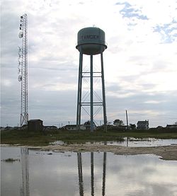
 丹吉尔的水塔 | |
|
丹吉尔旗幟 旗幟 | |
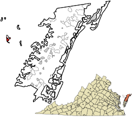
 位于弗吉尼亚州阿可麥克縣 | |
| 坐标:37°49′32″N 75°59′31″W / 37.8256°N 75.9919°W | |
| Country | 美国 |
| 州 | 弗吉尼亚州 |
| 縣 | 阿可麥克縣 |
| 面积 | |
| • 总计 | 1.2 平方英里(3.2 平方公里) |
| • 陸地 | 1.2 平方英里(3.2 平方公里) |
| • 水域 | 0.0 平方英里(0.0 平方公里) |
| 海拔 | 3 英尺(1 公尺) |
| 人口(2010) | |
| • 總計 | 727人 |
| • 密度 | 588人/平方英里(227人/平方公里) |
| 时区 | Eastern (EST)(UTC-5) |
| • 夏时制 | EDT(UTC-4) |
| ZIP code | 23440 |
| 電話區號 | 757 |
| FIPS code | 51-77520[1] |
| GNIS feature ID | 1500206[2] |
| 網站 | www |
丹吉尔(英語:Tangier)位于美国弗吉尼亚州阿可麥克縣,切萨皮克湾的丹吉尔岛。2010年人口普查为727人。[3]最初的定居者大多数来自英格兰西南部,[4]当地人有独特的英国口音。丹吉尔岛载入國家史蹟名錄。
参考资料
- ^ American FactFinder. United States Census Bureau. [2008-01-31]. (原始内容存档于2013-09-11).
- ^ US Board on Geographic Names. United States Geological Survey. 2007-10-25 [2008-01-31]. (原始内容存档于2012-02-26).
- ^ Profile of General Population and Housing Characteristics: 2010 Demographic Profile Data (DP-1): Tangier town, Virginia. U.S. Census Bureau, American Factfinder. [April 5, 2012]. (原始内容存档于2013-09-11).
- ^ Shores, David L., Tangier Island: Place, People and Talk (Cranbury, NJ: Associated University Presses, 2000), 1.
