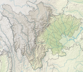
File:China Sichuan rel location map.svg
外观

此SVG文件的PNG预览的大小:695 × 600像素。 其他分辨率:278 × 240像素 | 556 × 480像素 | 890 × 768像素 | 1,187 × 1,024像素 | 2,374 × 2,048像素 | 1,370 × 1,182像素。
原始文件 (SVG文件,尺寸为1,370 × 1,182像素,文件大小:1.21 MB)
文件历史
点击某个日期/时间查看对应时刻的文件。
| 日期/时间 | 缩略图 | 大小 | 用户 | 备注 | |
|---|---|---|---|---|---|
| 当前 | 2023年9月4日 (一) 18:10 |  | 1,370 × 1,182(1.21 MB) | NordNordWest | upd |
| 2022年2月19日 (六) 12:00 |  | 1,370 × 1,182(1.22 MB) | NordNordWest | == {{int:filedesc}} == {{Information |Description= {{de|1=Positionskarte von Sichuan, Volksrepublik China}} {{en|1=Location map of Sichuan, People's Republic of China}} {{Location map series N |stretching=115 |top=34.5 |bottom=25.8 |left=97.1 |right=108.7 }} |Source={{Own using}} * United States National Imagery and Mapping Agency data * World Data Base II data * ETOPO1 data |Date=2022-02-19 |Author={{U|NordNordWest}} |Permission= |other_versions=<gallery>China Sichuan adm location map.svg</g... |
文件用途
以下76个页面使用本文件:
- 2018年宜宾地震
- 2019年自贡地震
- 2021年泸县地震
- 2022年泸定地震
- 三岔水库
- 三岔河水库
- 三溪口水库 (泸县)
- 东禅寺水库
- 两河口水库 (眉山)
- 乌东德水电站
- 九寨沟风景名胜区
- 书房坝水库
- 五排水水库
- 元兴水库
- 全民水库
- 化成水库
- 升钟水库
- 友谊水库 (蒙溪河)
- 古宇庙水库
- 同心桥水库
- 四姑娘山
- 回龙水库
- 团结水库 (内江)
- 复兴水库 (青神)
- 大岗山水电站
- 大涼山
- 大深沟水库
- 大高滩水库
- 婆缪峰
- 张家岩水库
- 总岗山水库
- 报花厅水库
- 文家阁水库
- 新店水库
- 新路海
- 星花水库
- 木桥沟水库
- 松林水库 (内江)
- 柏林寺水库
- 柏林水库
- 格聂峰
- 毛坝水库
- 洪峰水库
- 海螺沟
- 瀑布沟水电站
- 猫儿山 (南充市)
- 瓦屋山
- 白桥水库
- 白水河水库
- 百丈水库
- 磨滩河水库
- 紫坪铺水利枢纽
- 继光水库
- 翠湖 (岳池)
- 老鹰水库
- 莲花洞水库
- 葫芦口水库
- 蟠龙河水库
- 贡嘎山
- 跑马滩水库
- 郝家村水库
- 锦屏一级水电站
- 长沙坝水库
- 雀儿山
- 雀儿山口
- 雪宝顶
- 黄板桥水库
- 黄河镇水库
- 黄龙风景名胜区
- 黑龙滩水库
- 龙头石水电站
- 龙江水库 (资中)
- Template:Location map China Sichuan
- Template:Location map China Sichuan relief
- Module:Location map/data/China Sichuan
- Module:Location map/data/China Sichuan/doc
全域文件用途
以下其他wiki使用此文件:
- de.wikipedia.org上的用途
- en.wikipedia.org上的用途
- Mount Emei
- Leshan Giant Buddha
- Sanxingdui
- Huanglong Scenic and Historic Interest Area
- Dujiangyan
- Daxue Mountains
- Mount Gongga
- Mount Qingcheng
- Sichuan Giant Panda Sanctuaries
- Wolong National Nature Reserve
- Shaximiao Formation
- Ge'nyen Massif
- Pearl Shoal Waterfall
- Lugu Lake
- Conquest of Shu by Wei
- Pubugou Dam
- Diexi Lake
- Tangjiashan Lake
- Module:Location map/data/China Sichuan/doc
- Qionglai Mountains
- Mount Pomiu
- Dagangshan Dam
- Changheba Dam
- Jinping-I Dam
- Jinping-II Dam
- Mount Siguniang
- 2013 Lushan earthquake
- Daliang Mountains
- 2014 Kangding earthquake
- Yihun Lhatso
- Rongme Ngatra
- User:Dyadicdan/sandbox
- 2017 Sichuan landslide
- 2017 Jiuzhaigou earthquake
- Jinping Mountains
- Feitianshan Formation
- Module:Location map/data/China Sichuan
- Module:Location map/data/Sichuan
- User:Ty654/List of earthquakes from 1900-1949 exceeding magnitude 7+
查看此文件的更多全域用途。


